Two days ago I quickly posted images from the afternoon group hike to Ward’s Falls. Today we woke to a surprise snow day. We weren’t supposed to get this much white stuff until further into the weekend. But, here we are, somewhat housebound. And before I immerse myself in a long overdue studio reorganization I wanted to share a few more images and more details from the hike.

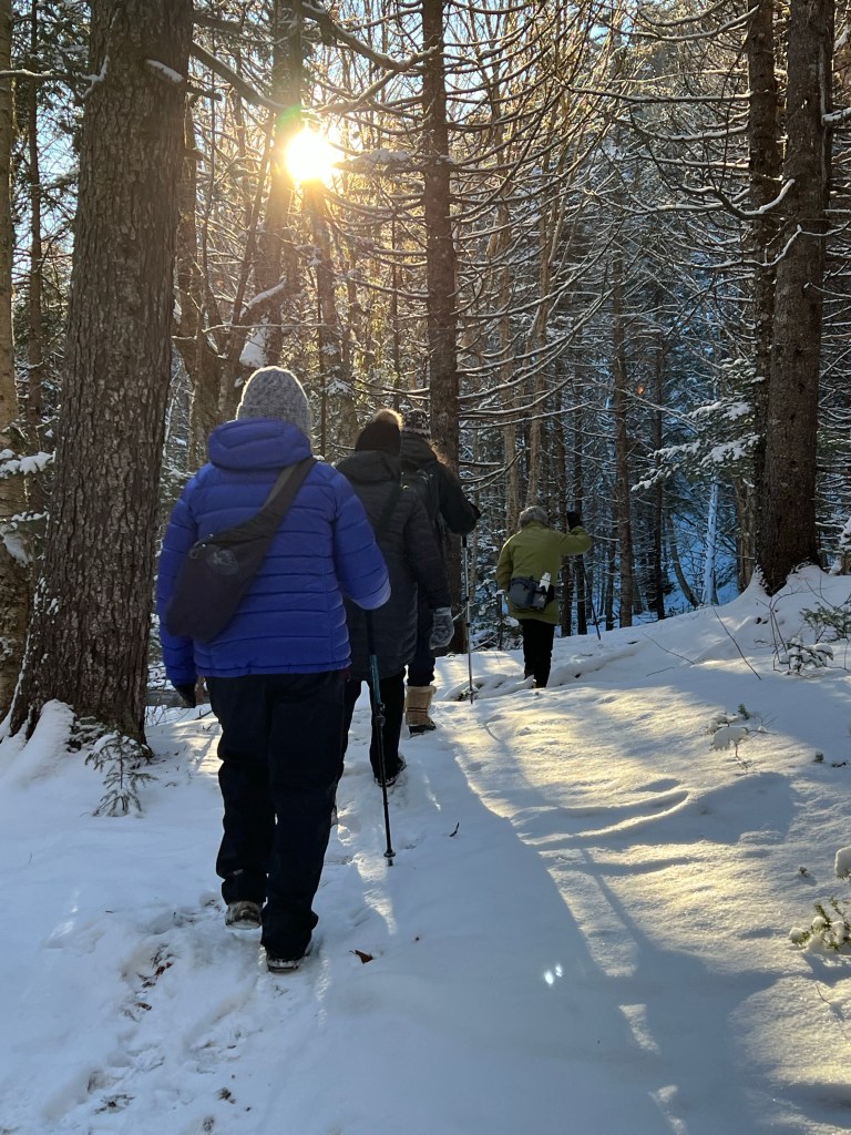
This hiking trail is considered Level 1 terrain with some higher levels sections, meaning: challenging sections. The narrow trail requires attention due to protruding tree roots and rocks. On Wednesday the trail was snow-covered, with about 1” of powder. There are several sections that have experienced minimal flooding. The wet areas had frozen and navigating these sections was relatively easy.
The first of three challenging sections is roughly 400 m from the trailhead. Negotiating it with poles in single-file was the way we conquered the undulating terrain. The second section is found approximately ⅓ of the way to the falls, a distance of about 1.5 km from the trailhead. There the path presents with a steep incline coupled with very rough terrain. A rope is provided to assist with the ascent and equally steep descent. Wrapping the rope around one’s arm will further help with staying upright. Most of us used poles, an additional helpful piece of equipment to carry.


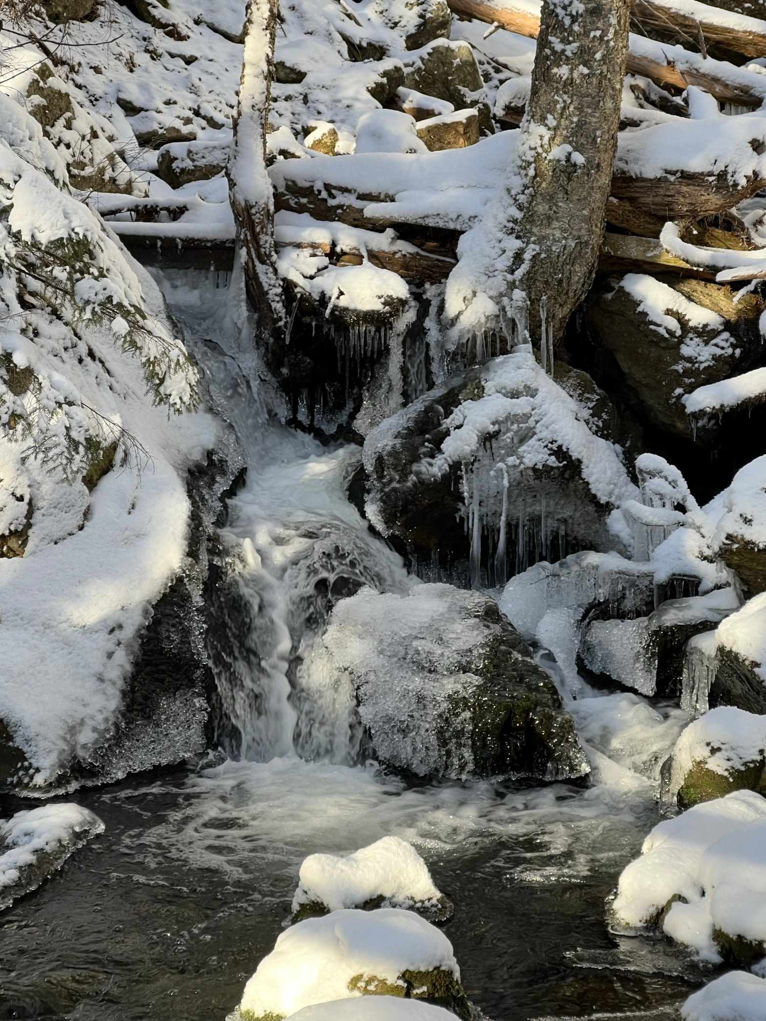
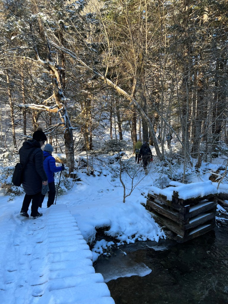
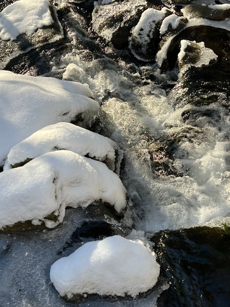
This scenic hike is stunning at any time of the year. 16 bridges lead to the destination, an imposing granite wall eroded for millennia, where a stunning waterfall has carved its path. It is one of two so-called slot canyons in our area of the Cobiquit Mountains. During the colder months, icicle formations offer unique photo opportunities.


I have already mentioned two challenging sections to navigate along the trail, the location of the third and last section is immediately following the final bridge. I discouraged everyone from climbing it on this hike as it was impossible to determine how icy it would be. Everyone was cautious and in agreement that we will leave the climbing to the pool of Wards Falls for another time. After a short snack break, we headed back to the parking area.

The last time I hiked this popular trail was in mid-October, shortly after Fiona had blown through the area. At the time I didn’t realize how many trees were affected by the storm. With a dusting of snow over fallen trees and broken limbs, the damage was hard to ignore this week.
For anyone interested in following in our footsteps, here are some pointers to consider: We spent roughly 2.5 hours hiking at a leisurely pace. This included a 10-minute snack break at the turnaround point. We had ample time for photographs along the way and nobody raised concerns about the pace (too slow or too fast). The terrain requires focus and attention due to the uneven path riddled with tree roots and rocks. There were two trees that had fallen over the path but we cleared them easily. The trail is advertised as 7 km round trip but according to my step counter, it is more like 6 km round trip.
The most challenging sections remain the path through the trees along the brook and the final ascent past the bridge below the falls. If the ground was more frozen it might have been easier to negotiate the section along the shore of the brook. The securely fastened rope really helped with balance and steadiness.
Personal equipment must include hiking boots with excellent tread. We didn’t use cleats or micro-spikes due to the lack of ice and there wasn’t enough snow for snowshoes on the narrow trail either. We dressed in layers, some of us had to switch to mittens when gloves proved not sufficient for warmth.
I hope this detailed account of our hike is helpful in planning your outing to Wards Falls. Have a fantastic weekend, everyone! Best wishes, Anna

Wonderful details! I enjoyed the photos. That last image with the sun shrouded between the trees is almost magical!
LikeLiked by 1 person
It truly was a hike with magical light from start to finish.
LikeLike
Thanks for sharing these pictures Anna. It so reminds me of the wonderful times spent cross country skiing/hiking through the Rockies and their foothills. There really is something magical about wandering through that type of terrain where the show & water meet.
LikeLiked by 1 person
You are welcome! So glad the post brought back good memories.
LikeLike