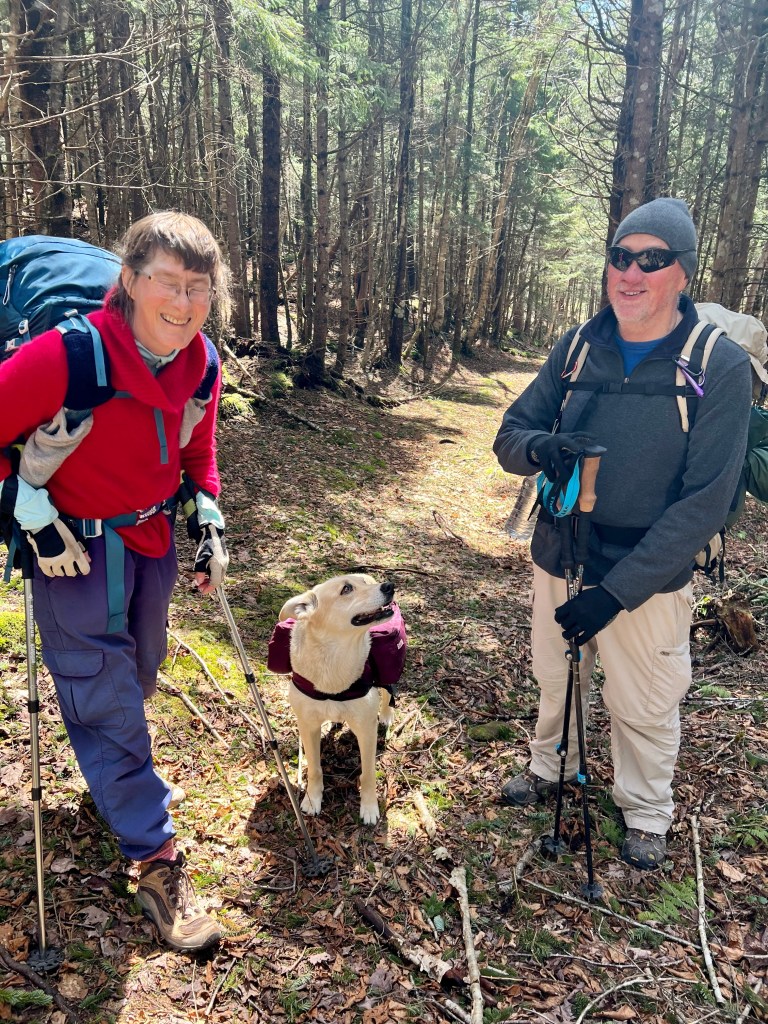
When you wake up one morning in February thinking you should circumnavigate Cape Chignecto you either shake your head and ignore the silly thought or you start conditioning. I first found myself a hiking partner with Cape Chignecto experience and then started training.
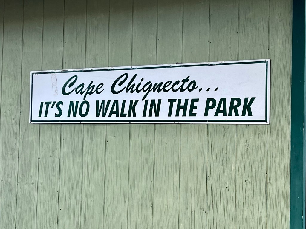
Each journey starts with a single step and the preparation for me started by reading as much about individual hiking experiences as possible. The trail is marked as “difficult” and that definition is consistent in the trail descriptions. What throws people off are the highly inaccurate videos and slideshows that pop up on Facebook and are widely distributed to promote circumnavigating Cape Chignecto Provincial Park as a “Fun Day in the Bay of FunDay” the messages get blurred. I had to find out for myself!
We set out Friday, May 5th at approximately 11 am. We pushed out starting time back to allow a little drying time after a rainy Thursday. Decomposing leaves and steep ascends present a huge challenge while balancing a 35 lb backpack.
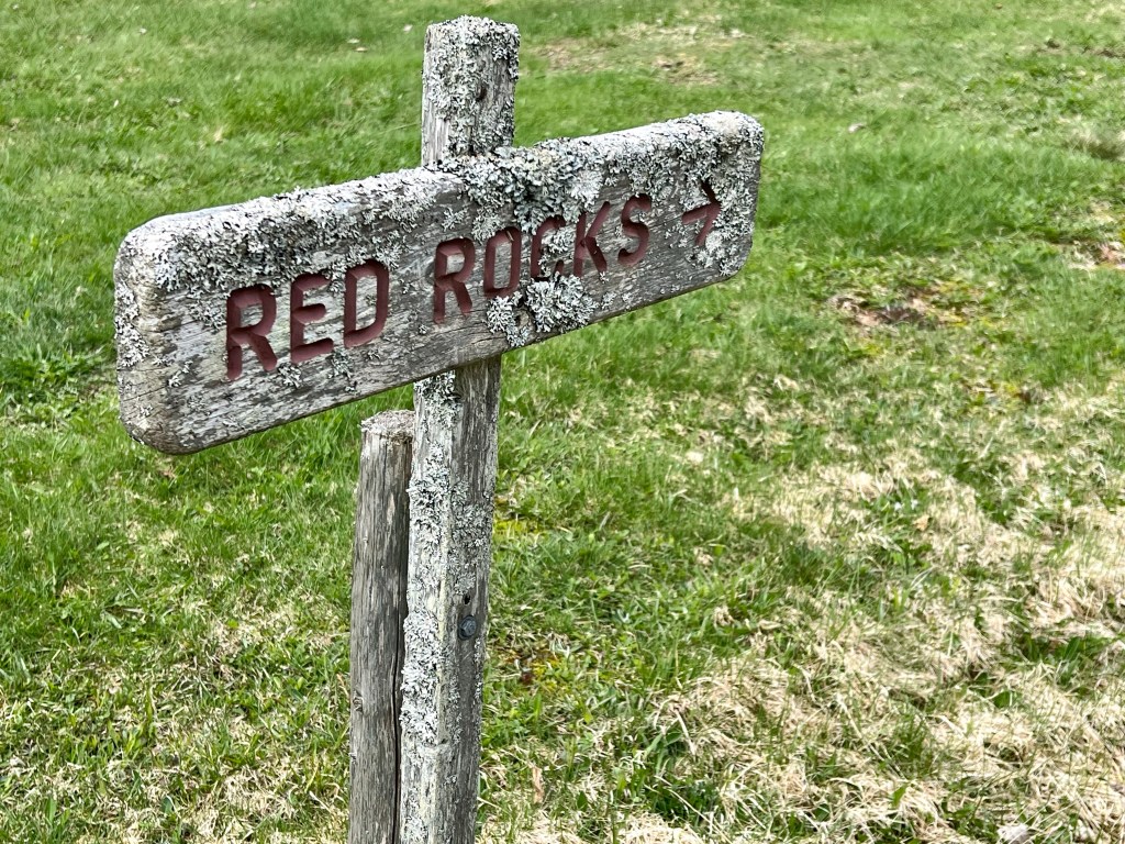
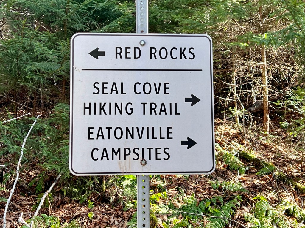
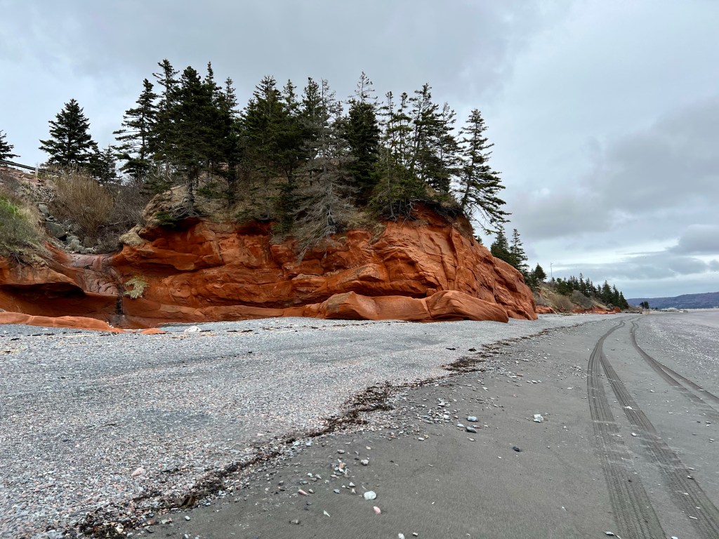
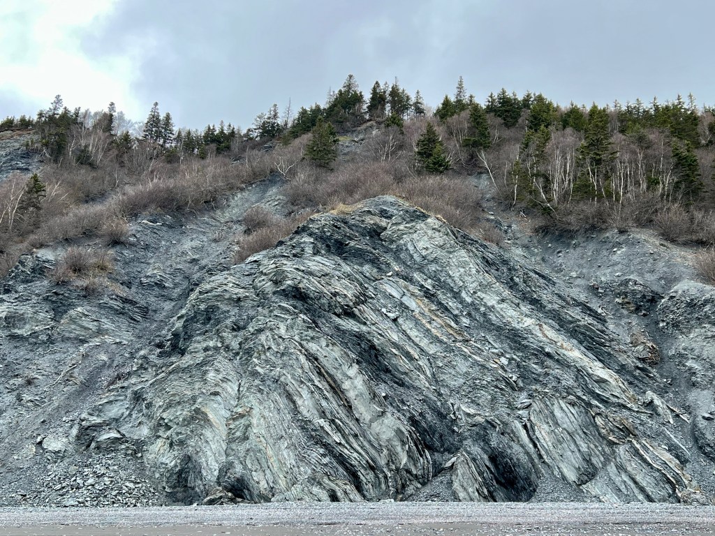
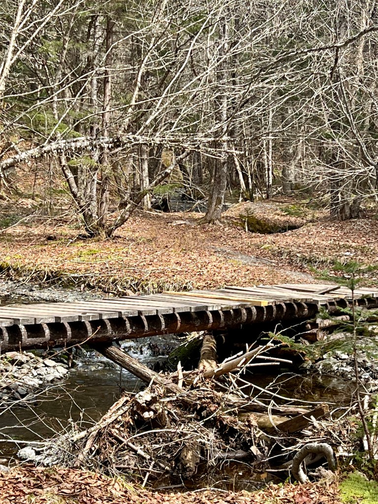
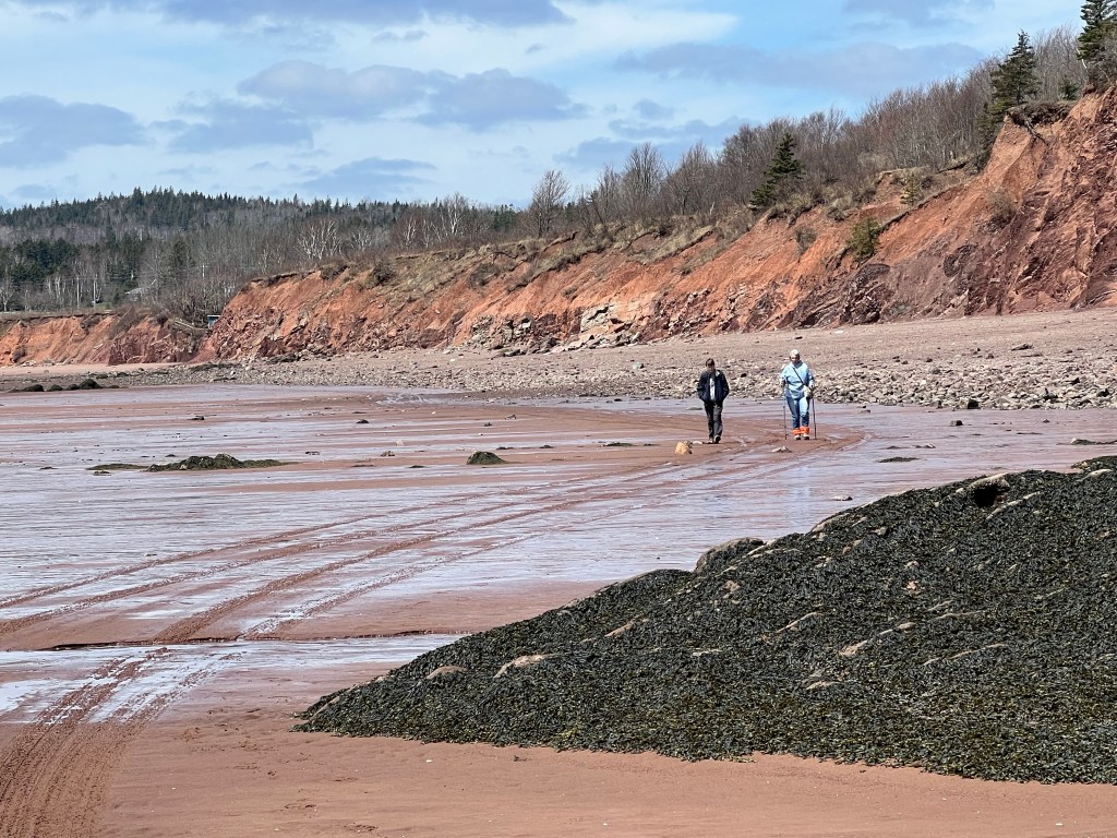
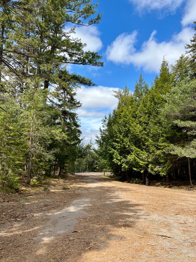
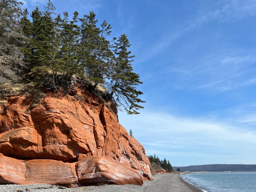
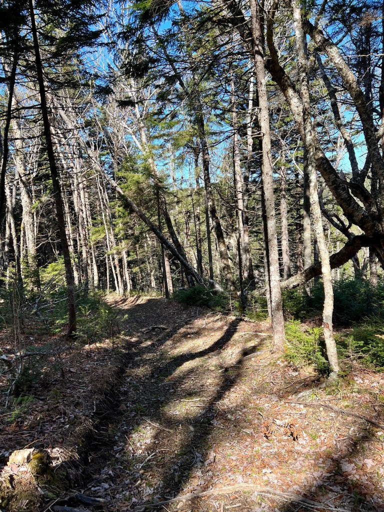
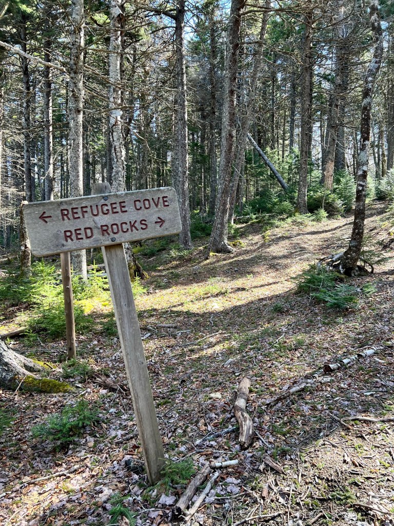
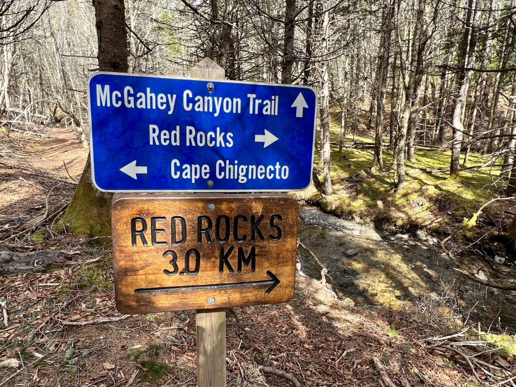
We followed our plan of hiking counter-clockwise. This meant that we started at the usual trailhead, Red Rocks, to the staircase at McGahey Brook. We followed the trail to the sign pointing to Eatonville and headed off into the mostly wooded terrain.
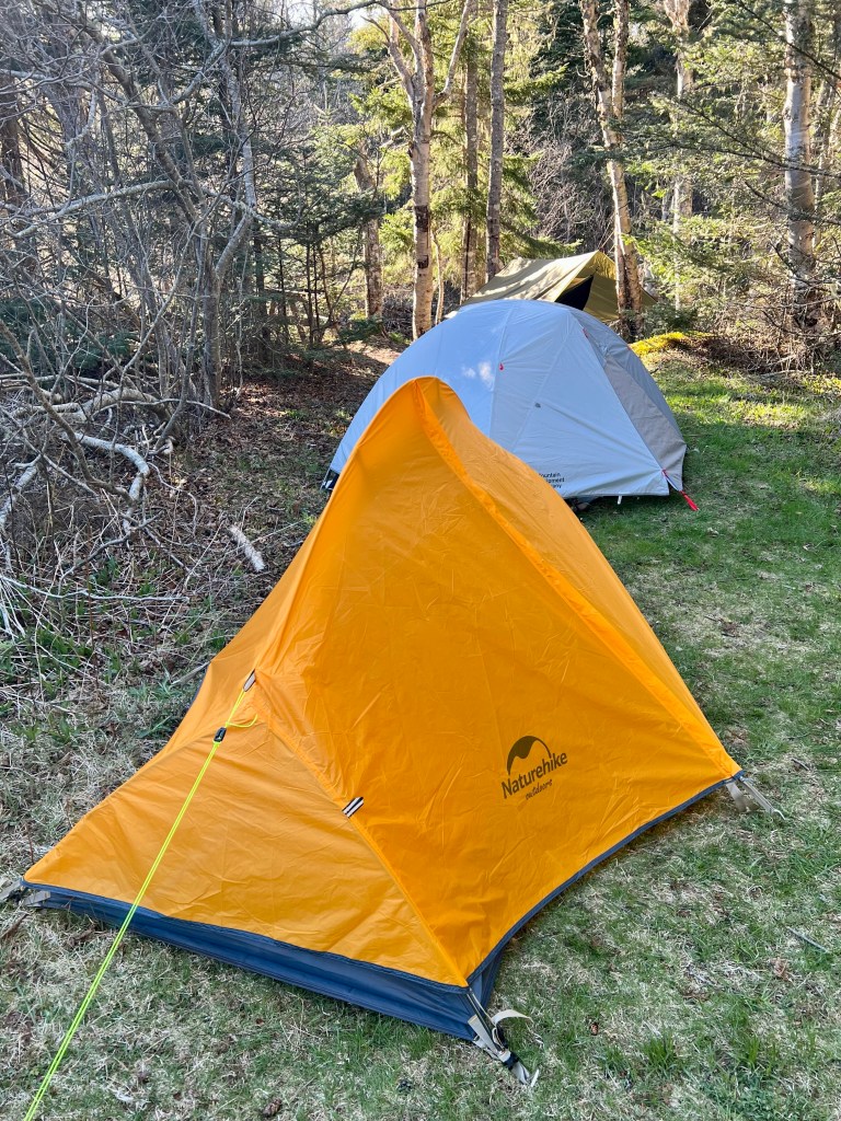
After a long and mostly gentle descent we arrived at our first campsite. Setting up our tents and hammock, turning our attention to dinner and, best of all, getting our boots off was a definite highlight.
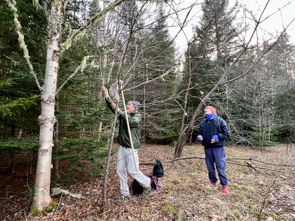
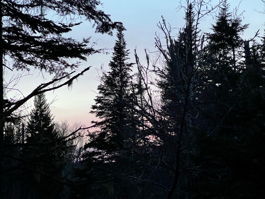
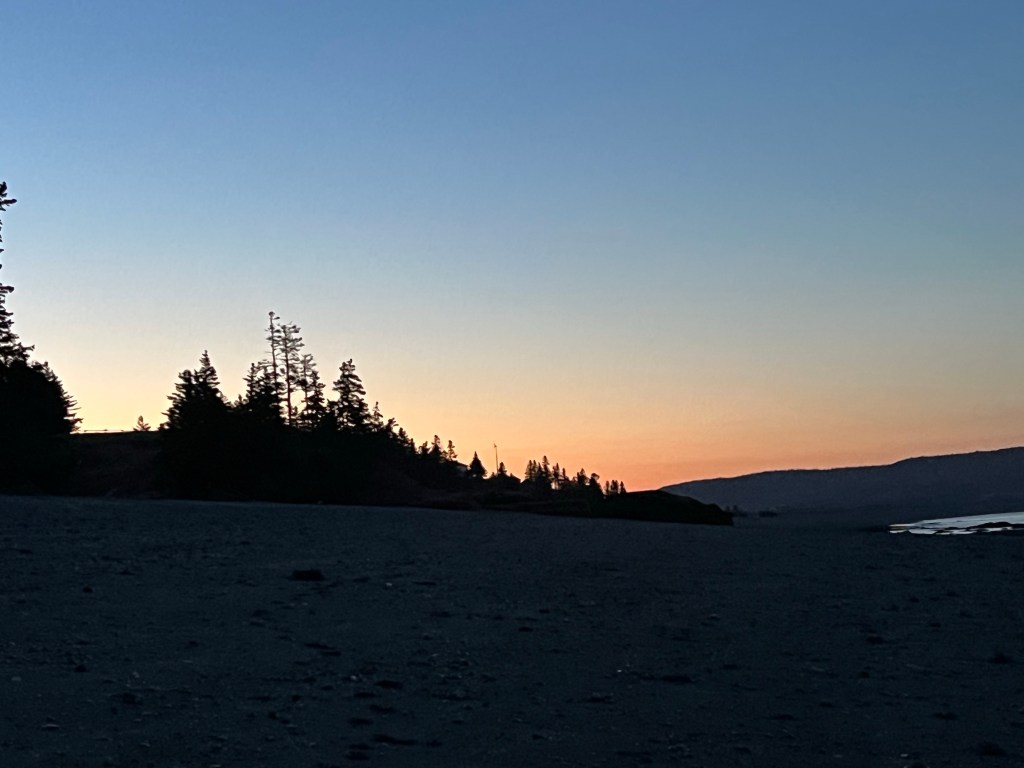
There was some worry about squirrels, mice and bears, so we did our best to suspend food supplies from a rope. Sunset treated us to soft pink skies through the trees… a full moon was rising and the temperature dropped well below freezing.😏
What doesn’t kill us makes us stronger, right? Check back tomorrow for instalment two.
We departed approximately 11 am on Friday morning and returned at the same time Monday morning.We were happy for all the conditioning we did and yet there were scrambles uphill that I would never have attempted two years ago. There was a challenging detour and a struggle for water at one point. But we made it out smiling. Best of all: we are still friends talking to each other! Thanks, Gaby, Enya and Brian for an epic adventure!
Getting home was equally exciting… Ash had her puppies early this morning! She is an awesome mom!
A proper hike report (in instalments) is forthcoming. I am sorting and editing images and preparing a detailed report.
Thank you for your interest in achieving this very personal goal of mine! I made it, shoulders are a little sore thanks to the 35 lb pack but there is no knee pain! I am truly thrilled!
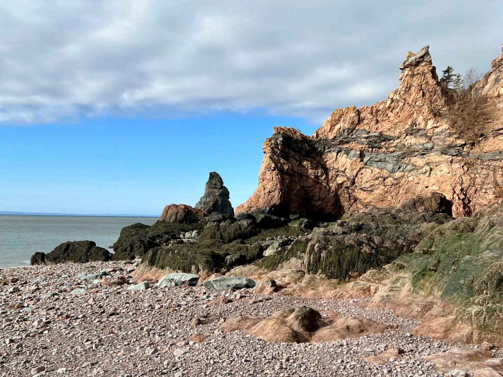
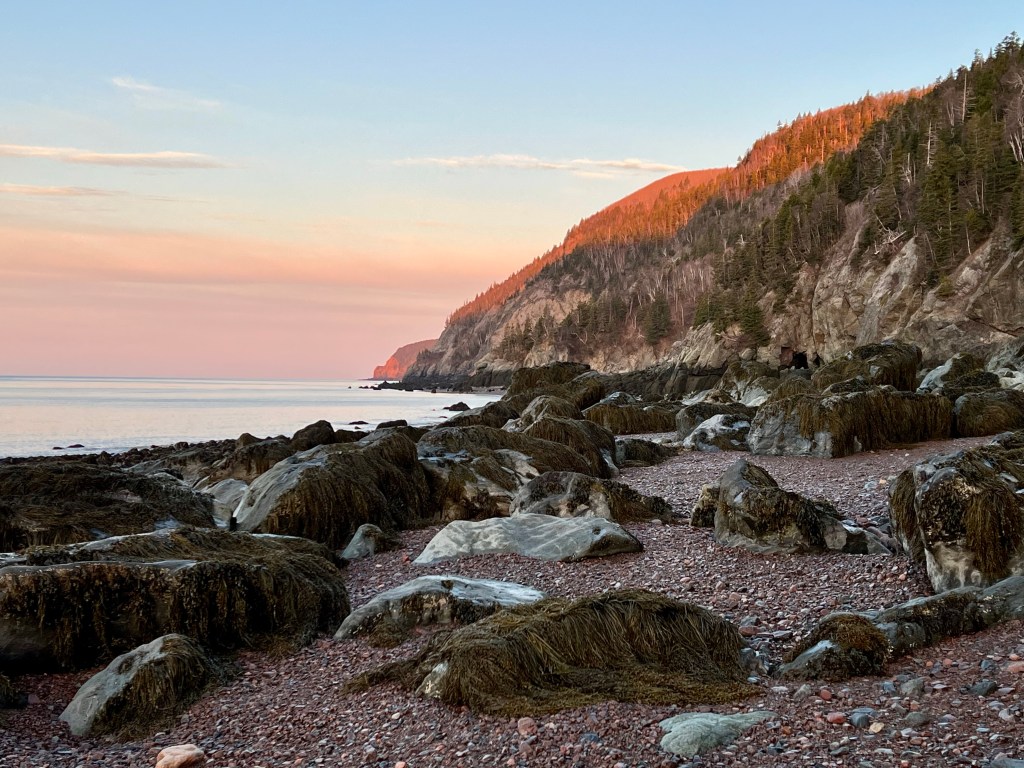
Assuming our hike continues on schedule we are overnighting close to this scenic setting, the sea-stack referred to as Ol’ Sal.
This is our last night on the trail. The last leg of the hike starts tomorrow morning and takes us up 500 meters, the second highest cliff along this coastal stretch. A good night’s rest is needed. 10 more kilometres and we are back at the trailhead parking lot. We are hoping for dry weather so the descents are not too treacherous.
I will be checking in from my couch tomorrow! Hope your Sunday was filled with great spring weather, Anna
Assuming all went well my friends and I have set up camp somewhere near Little Bald or Big Bald by now, fixing our second dinner and looking forward to a restful night without chilly toes😊.
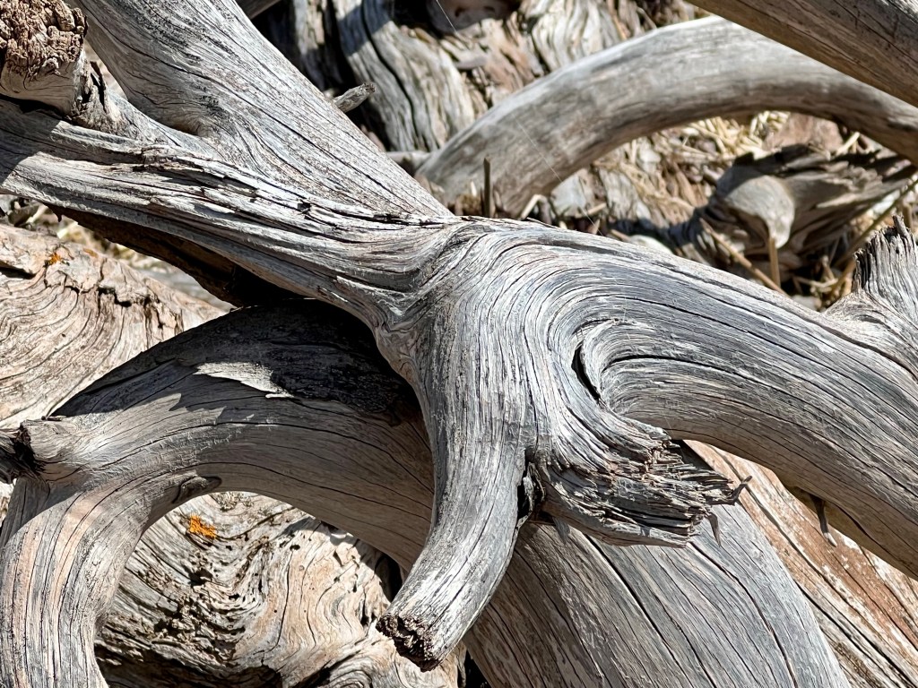
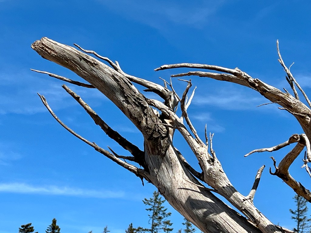
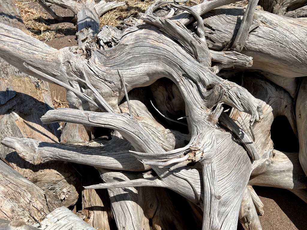
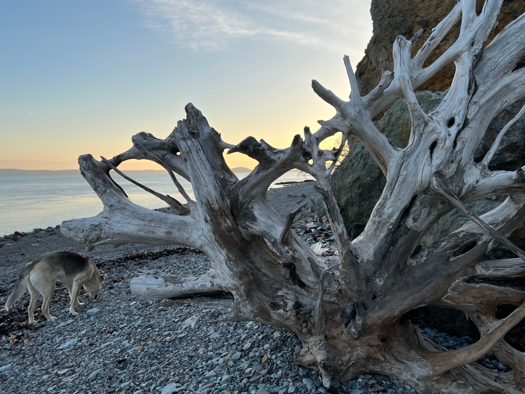
The images I share tonight are all from Cape Chignecto captured during our April day-hike to Refugee Cove.
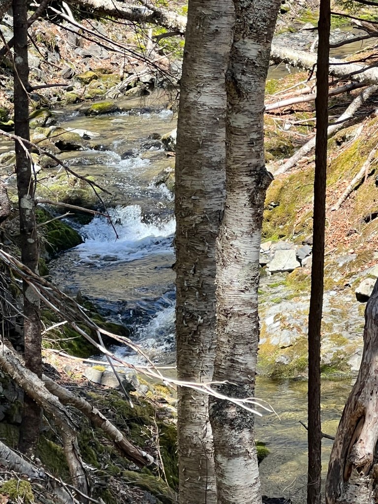
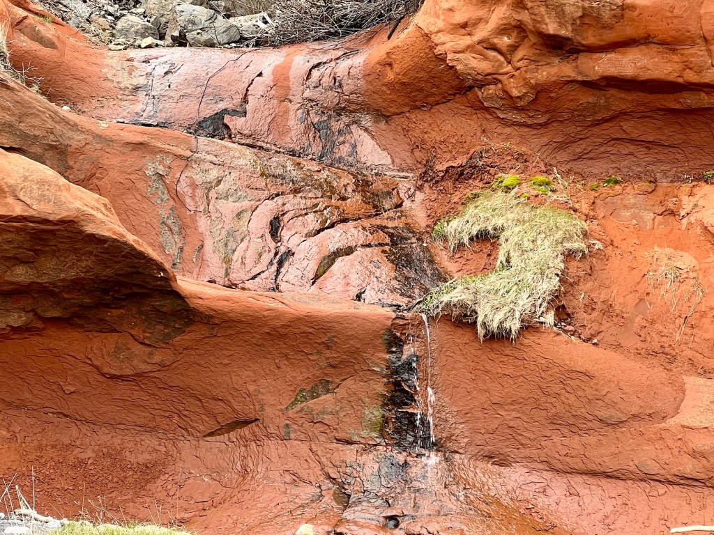
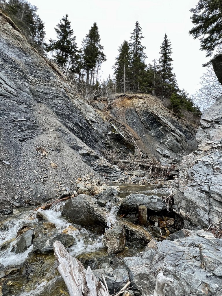
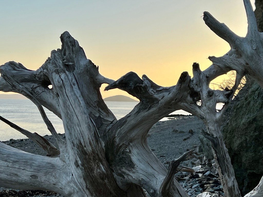
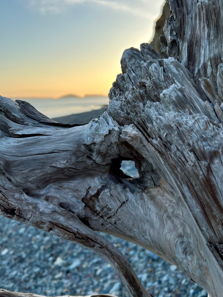
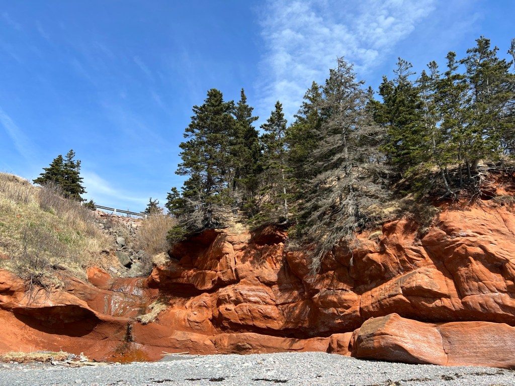
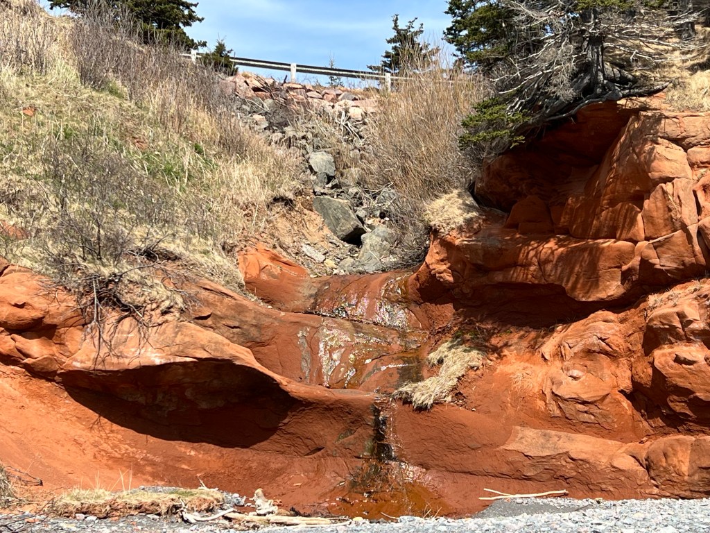
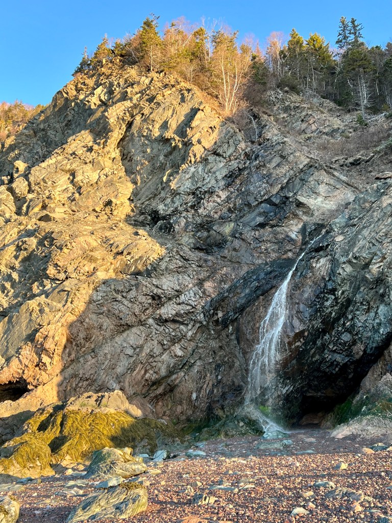
Hello from the trail, I am sharing a few landmark sights from Cape Chignecto Provincial Park over the next few days. As you view this post I will have passed by this brook and falls on our first leg of a four day back country hike. By the time this post goes live my friends and I will have hiked about 15 km, pitched our tents and are enjoying our evening meal.
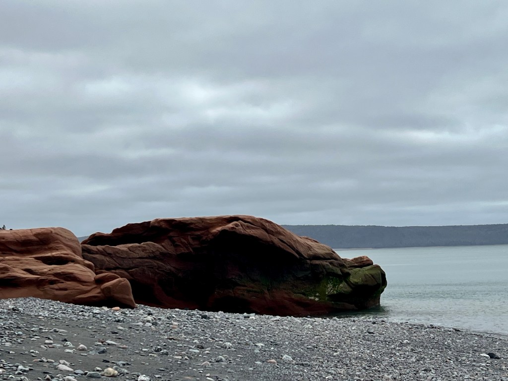
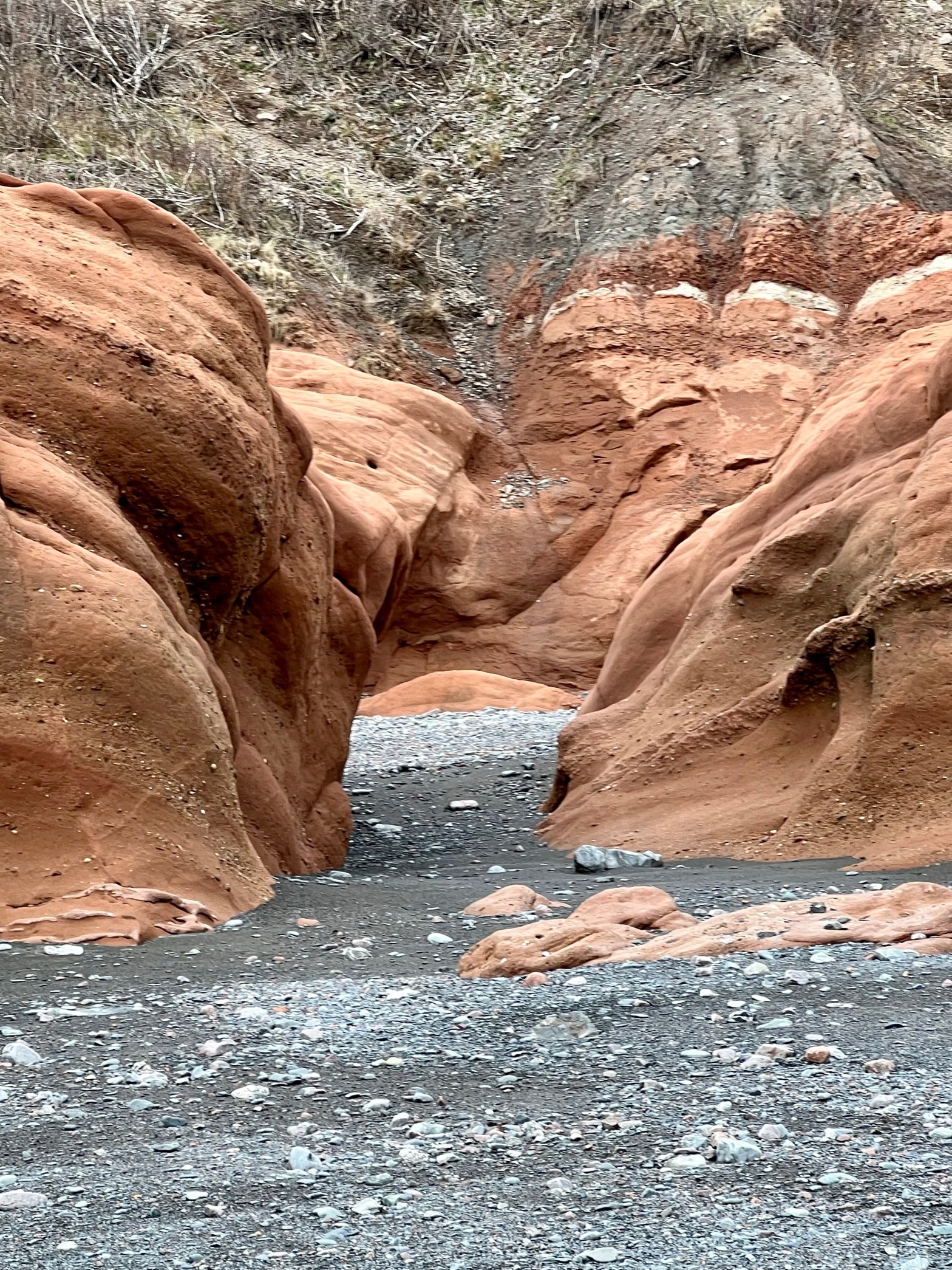
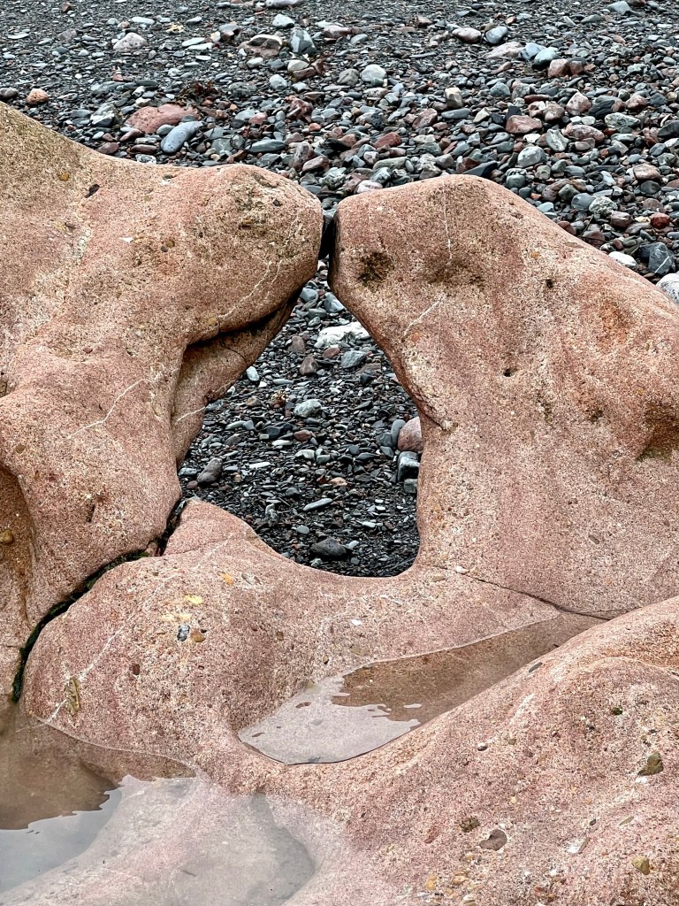
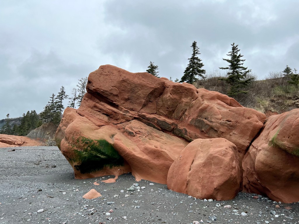
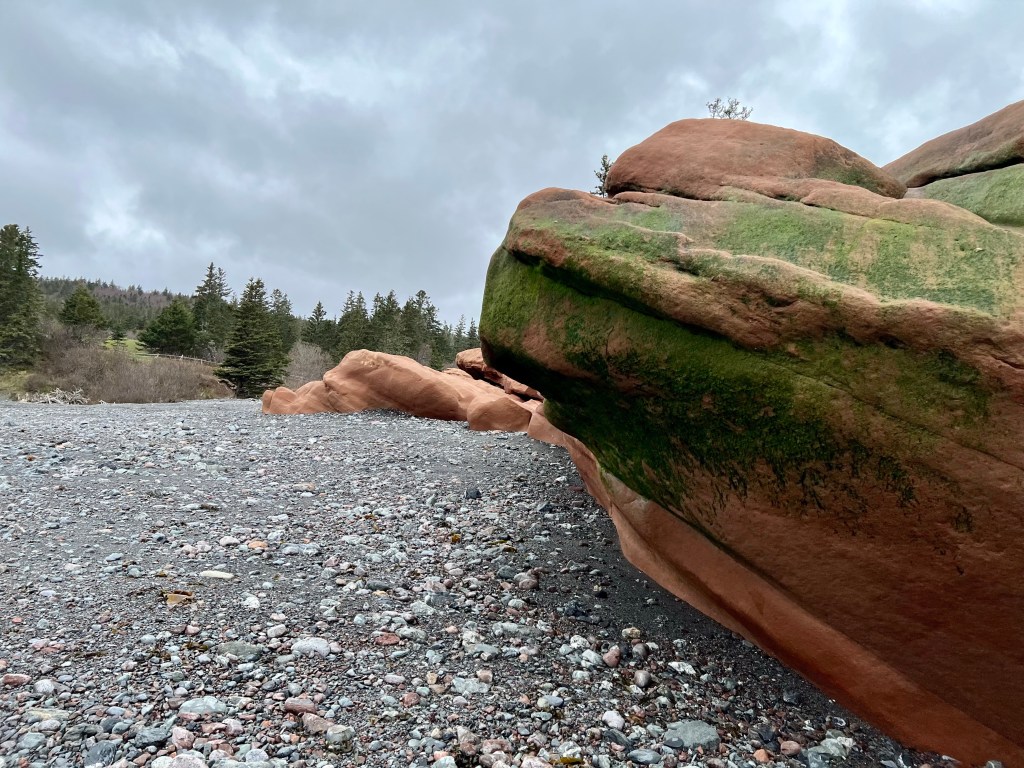
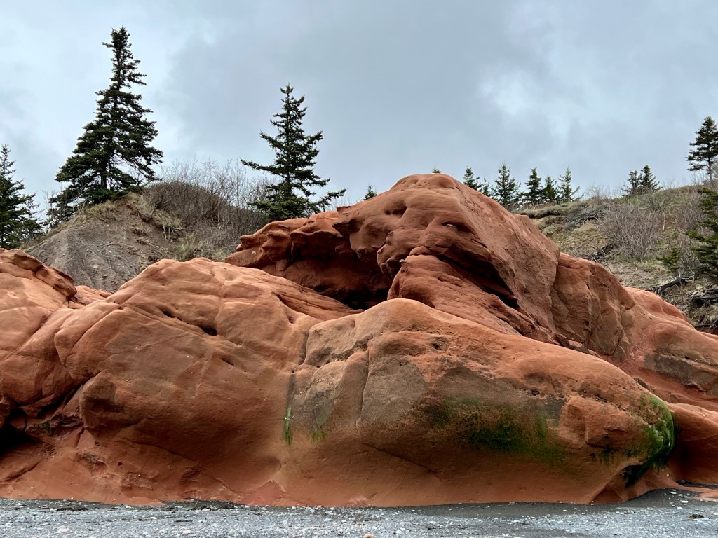
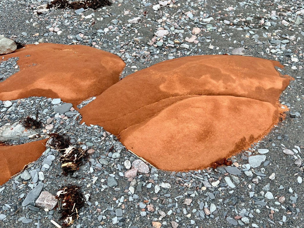
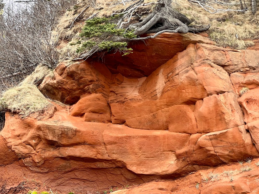
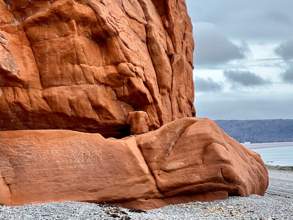
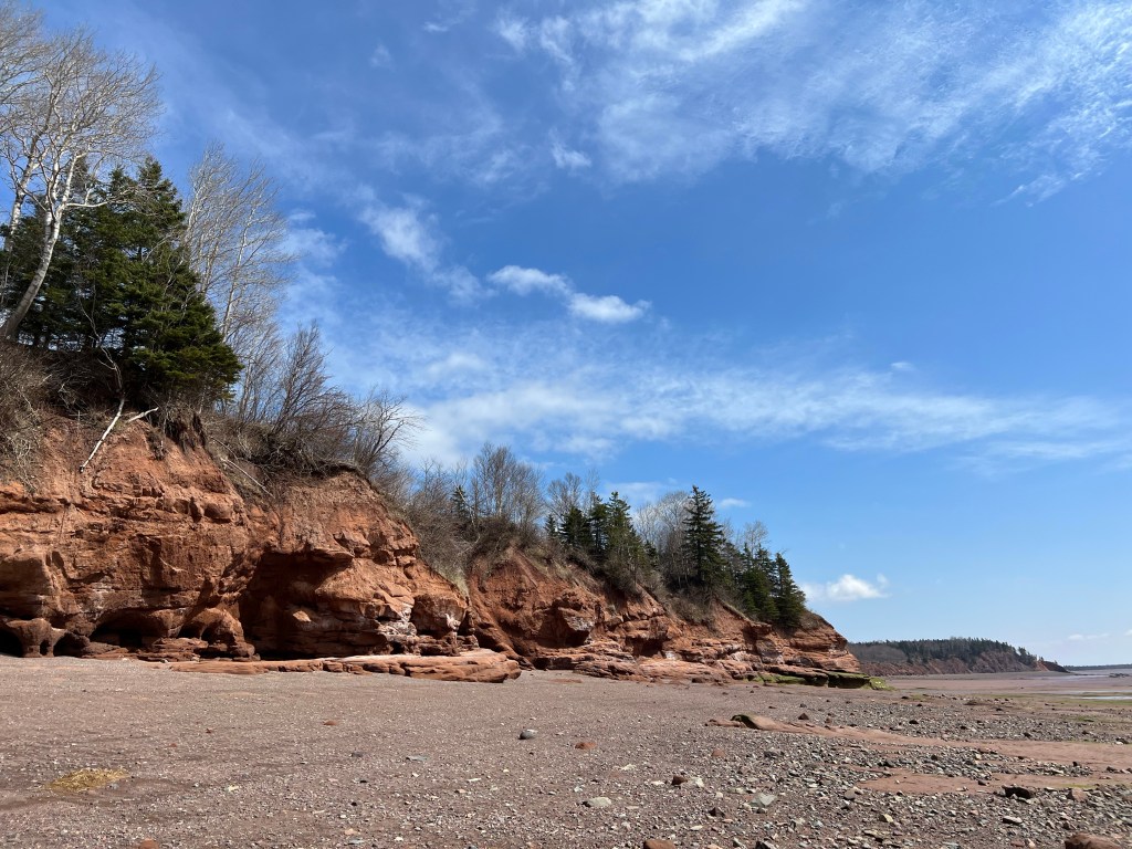
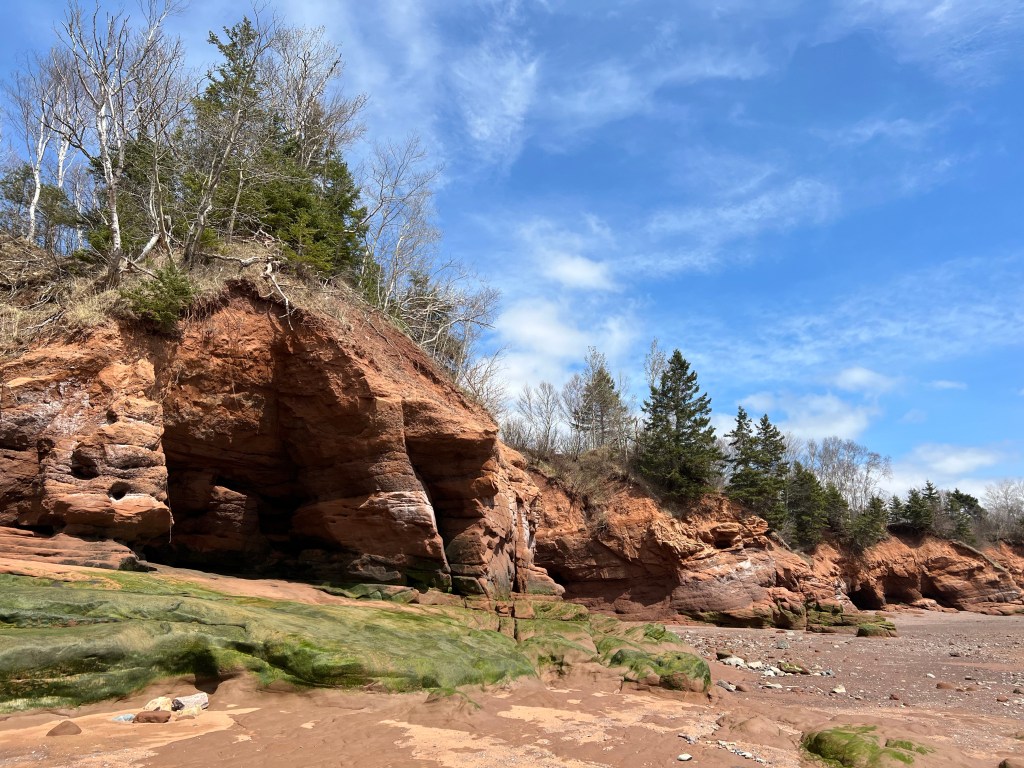
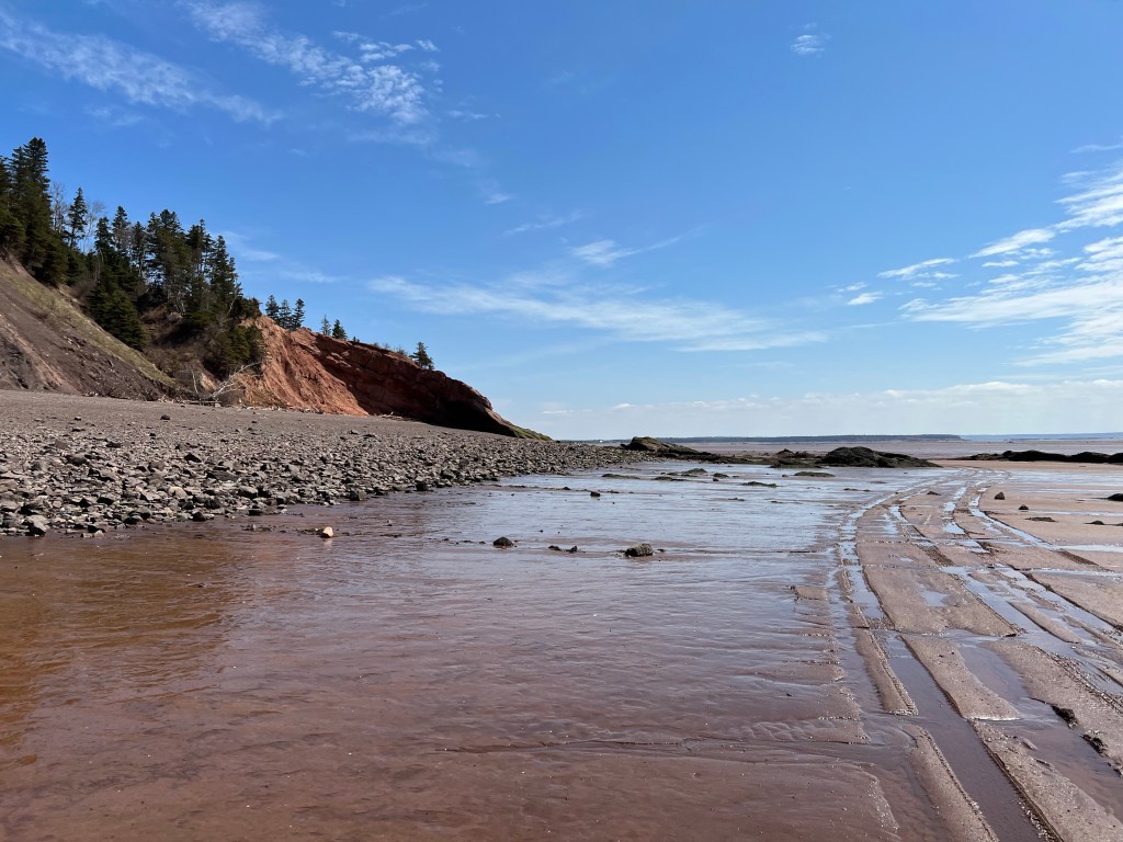
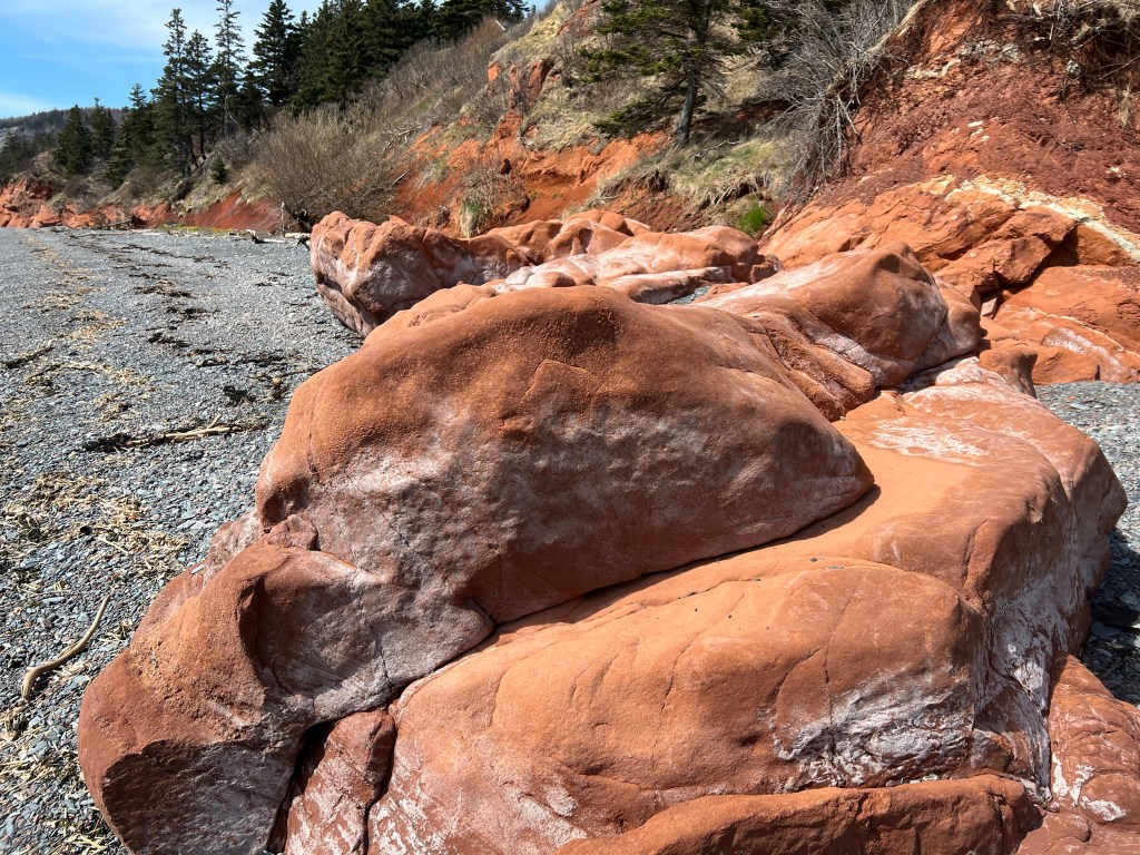
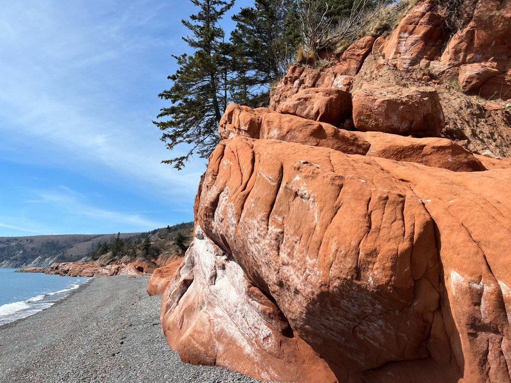
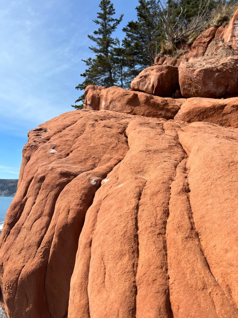
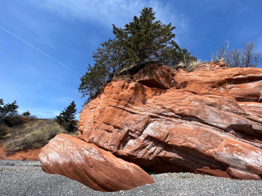
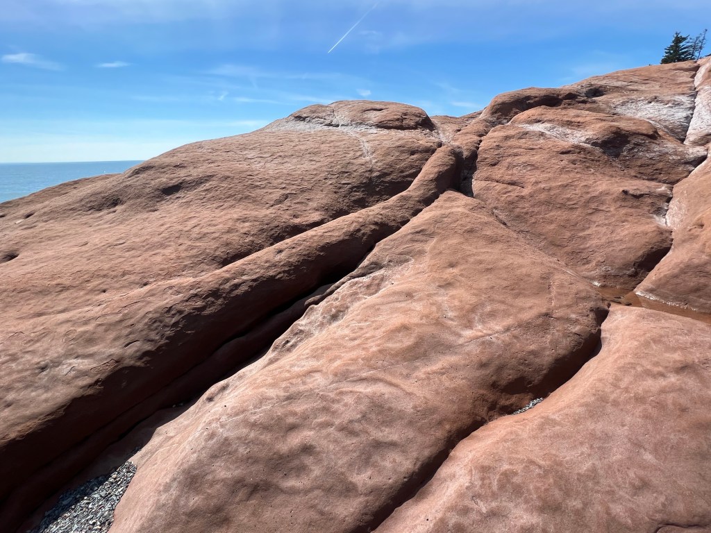
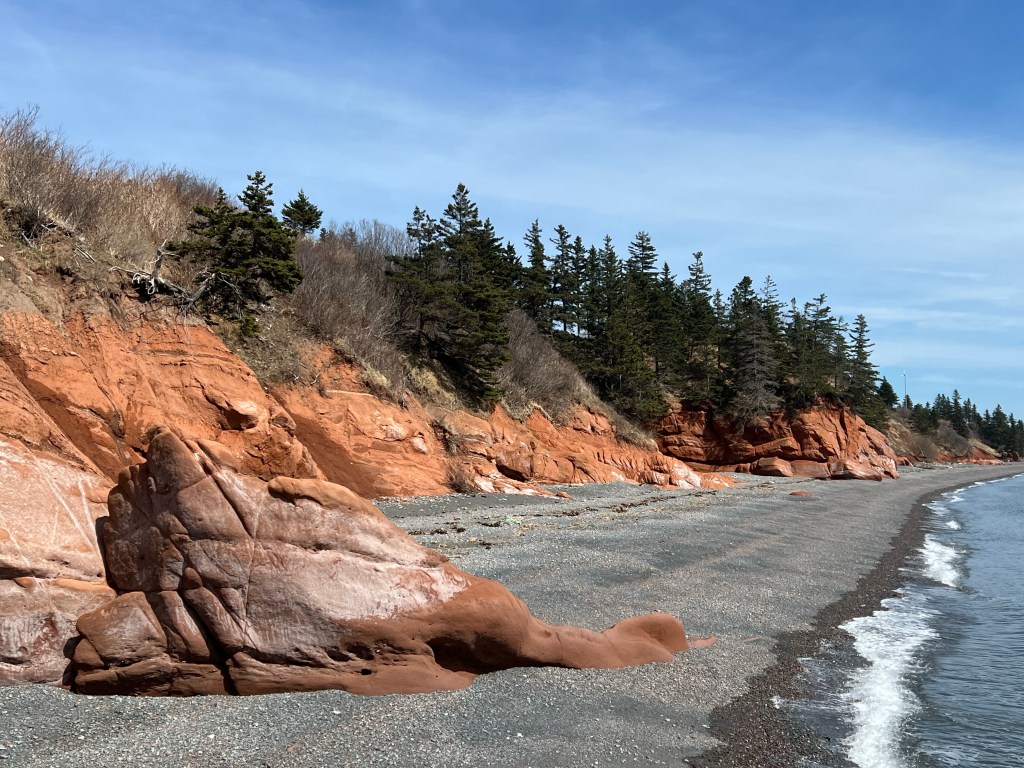
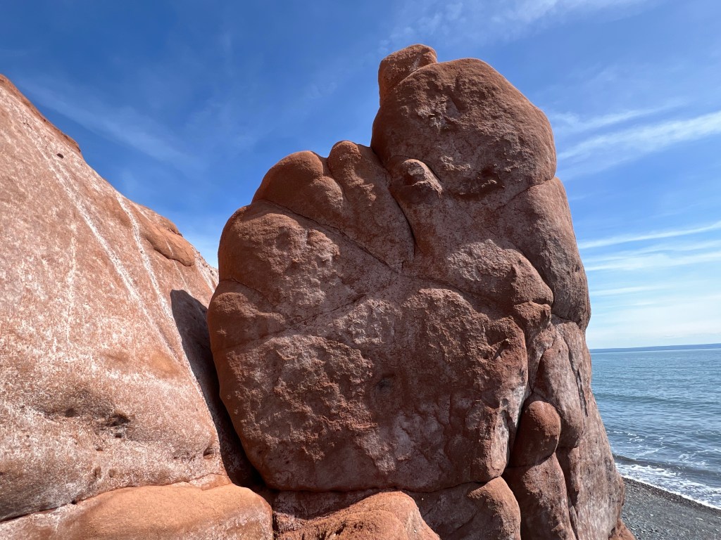
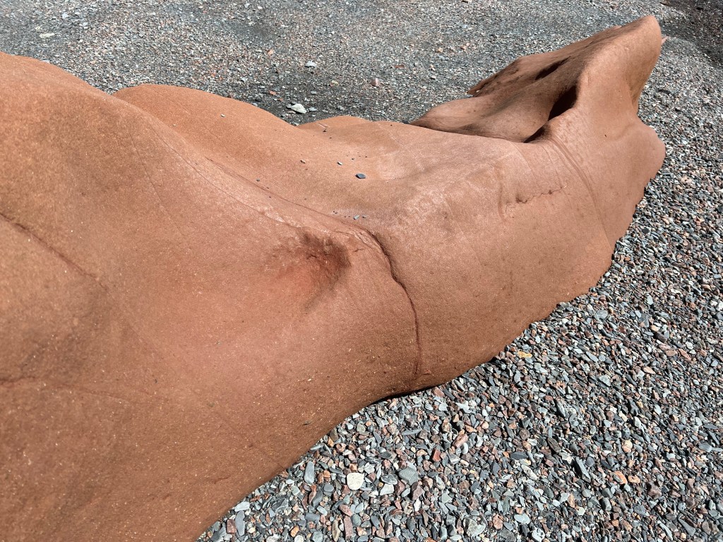
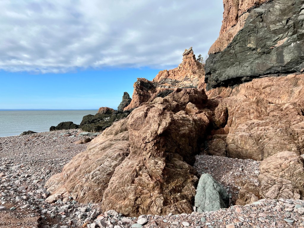
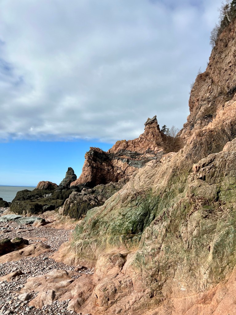
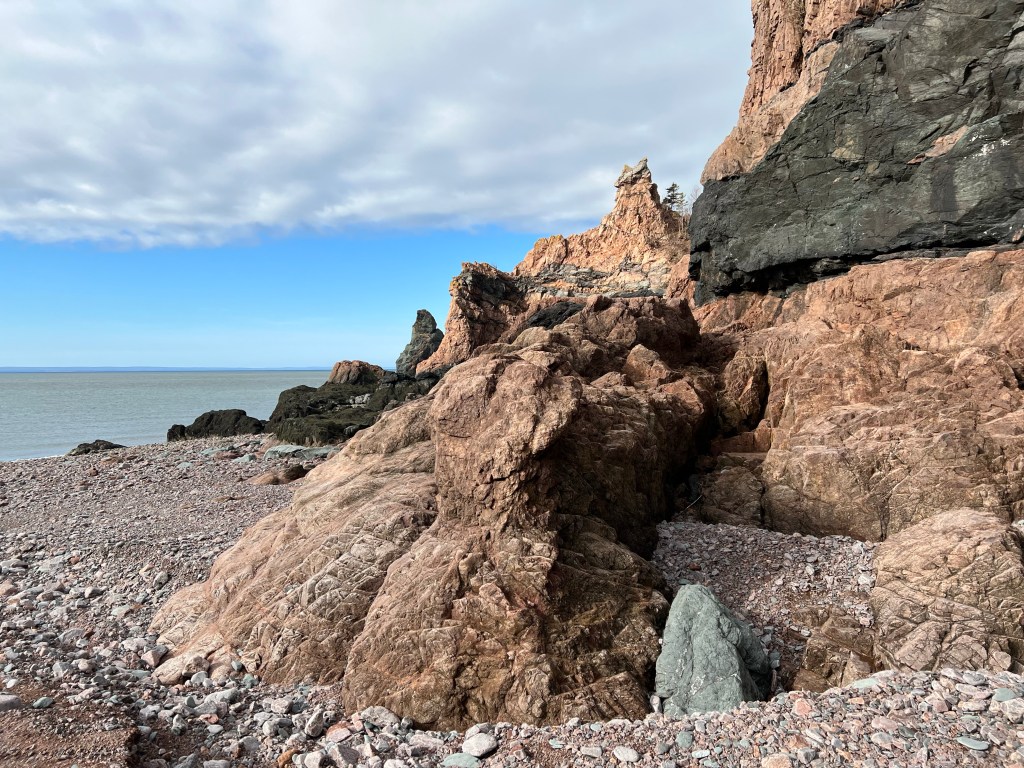
On a grey and drizzly day the Red Rocks along West Advocate Beach always add a splash of much needed colour. On the way toward McGahey Brook, our turn around point yesterday, the sandstone formations appeared to be of a soft pink. On the way back the light had changed slightly due to the angle of the sun behind the clouds. It was enough to give us an intense orange colour, one not to be overlooked!
The weather hasn’t improved much today… hope you enjoyed this colourful post! Happy Thursday, Anna
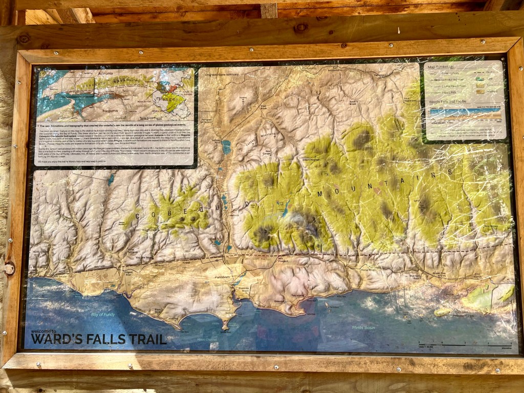
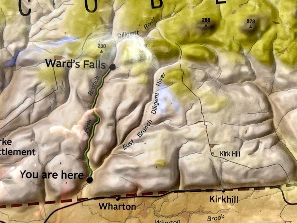
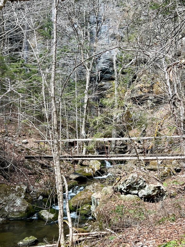
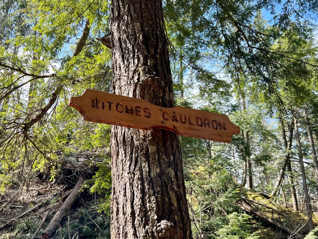
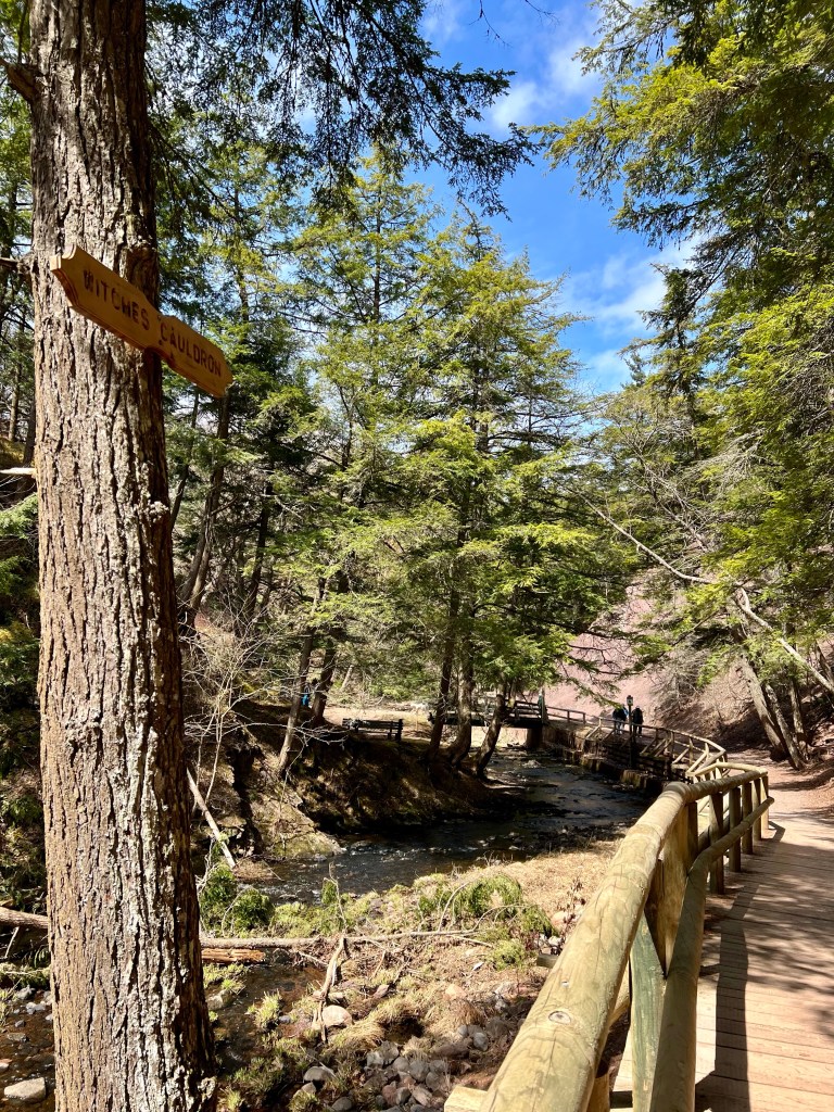
We ventured back to Wards Falls today. Our primary reason was for conditioning, the goal we set was to complete the trail twice with our full packs. The total distance we estimated was somewhere around 14 km.
We built in brief rests overlooking the falls each time and had lunch at the car after completing the first leg.
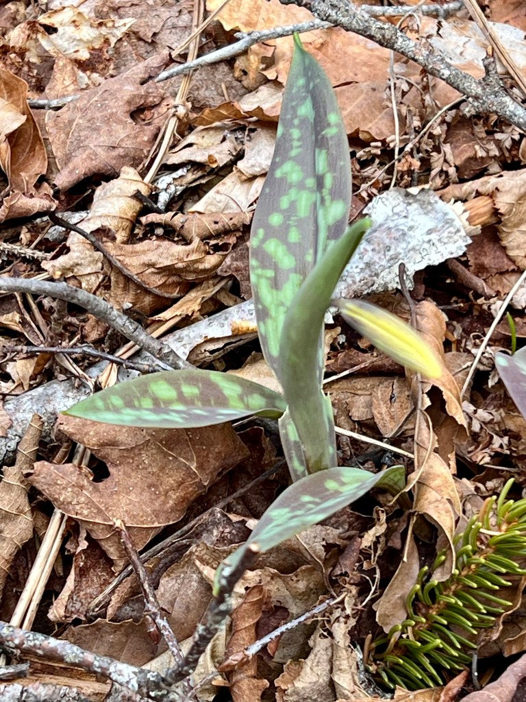
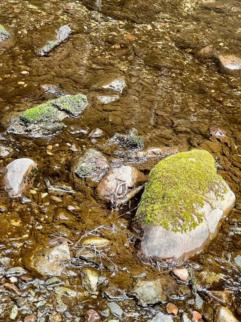
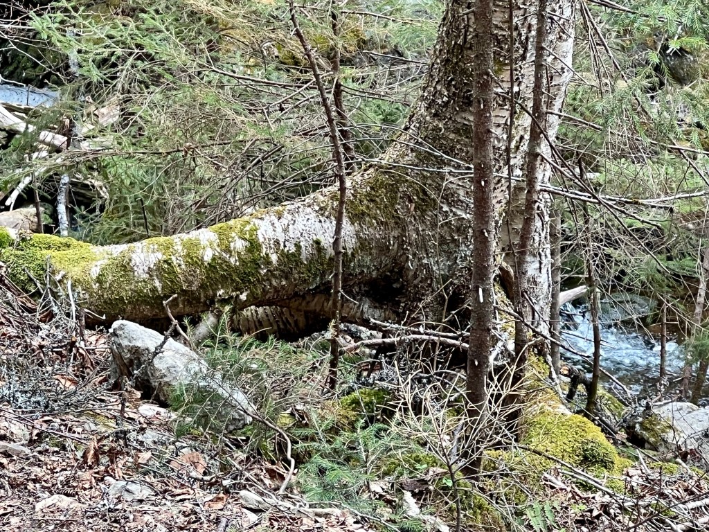
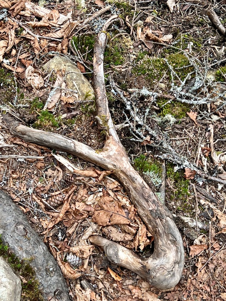
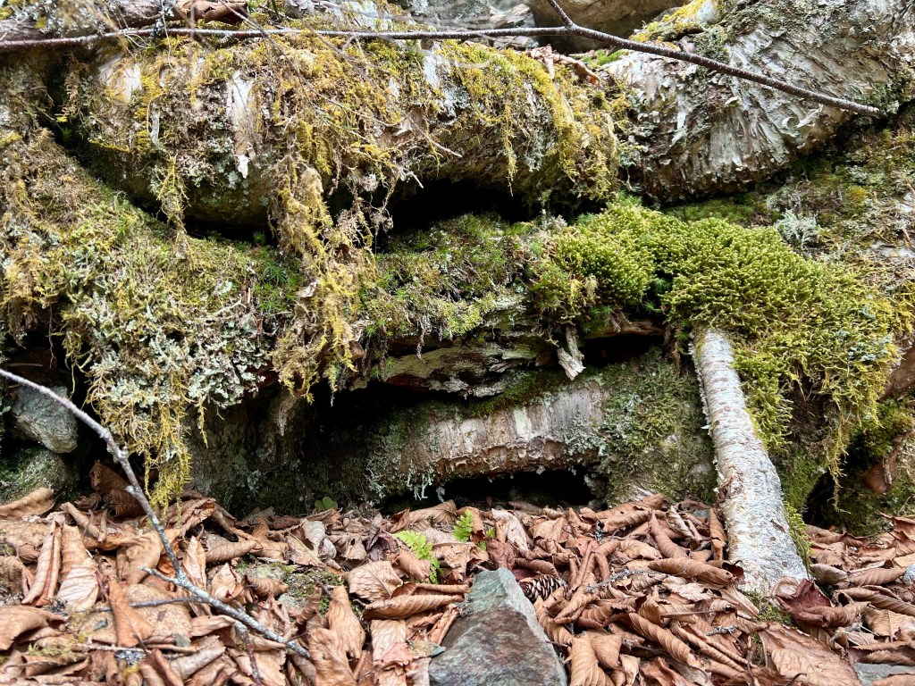
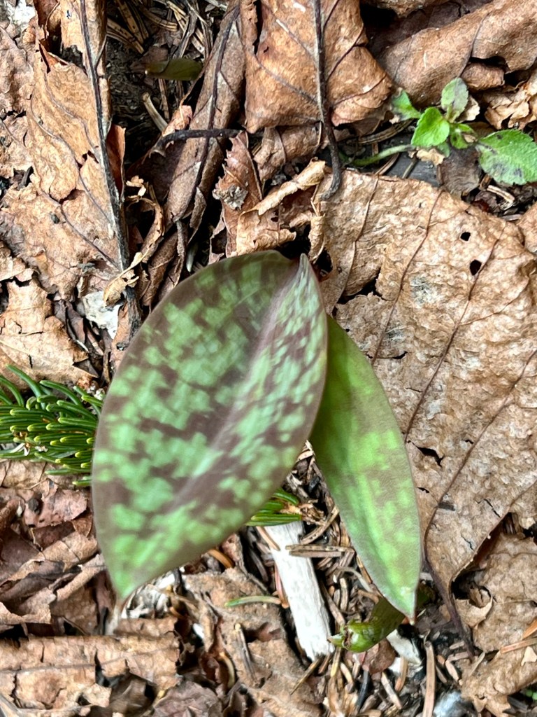
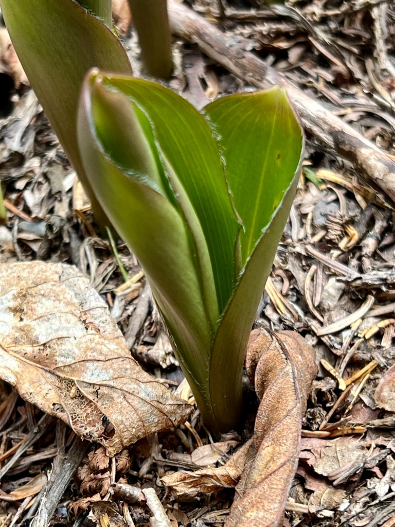
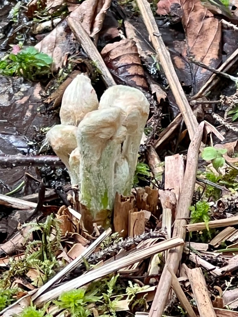
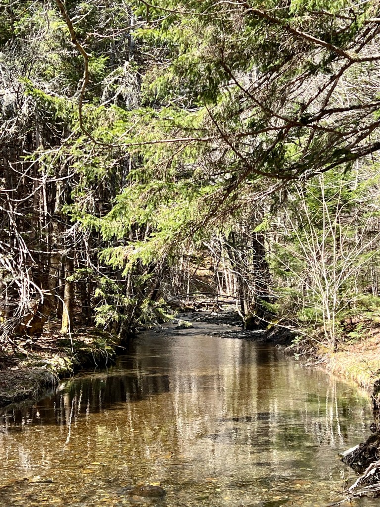
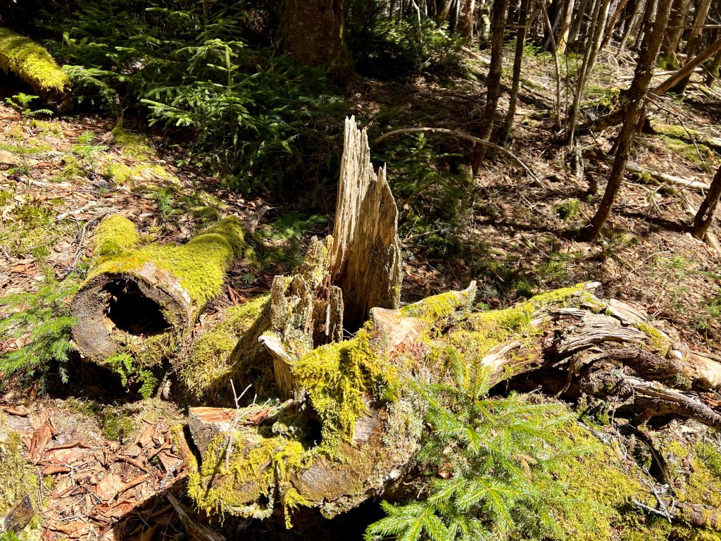
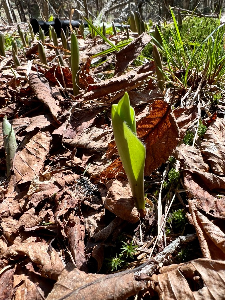
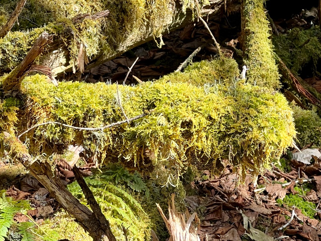
From moss covered rocks in the stream to tiny ferns emerging from a knot hole to fiddleheads unfurling… the springtime forest was magical!
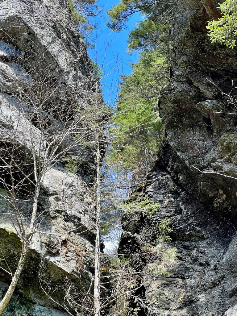
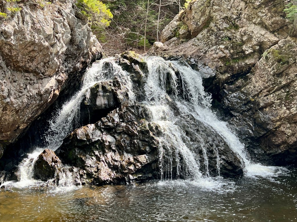
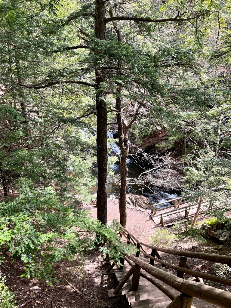
Seeing, hearing, experiencing the falls as the water rushed through the slot canyon past gigantic granit boulders was the highlight each time!
Hope your Sunday was filled with adventure! Best wishes for the start of a new week and a new month, Anna
With the sun out we decided to try a short hike with our full packs. Gaby and I each carried just over 30 lbs to see how we manage.
The trail was virtually deserted, sunlight illuminated our surroundings adding springtime magic. Small waterfalls were rushing toward the stream.
Soon we spotted the 16th bridge and we could hear the water rushing through the ancient slot canyon.
We easily ascended the steep terrain despite our heavy packs.
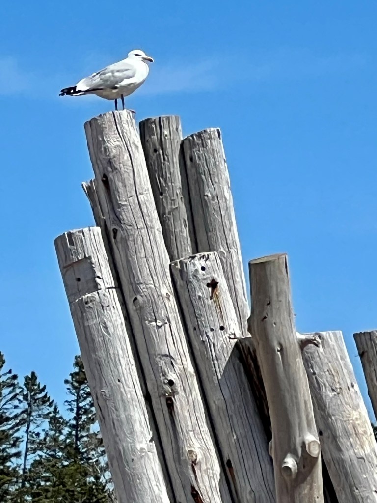
After a brief rest we made our way back to the parking area. More magic light across the woodland terrain and birdsong kept our hearts and steps light.
What a way to spend a Friday afternoon! Wards Falls is located on Hwy 209 between Parrsboro and Diligent River, only about 10 minutes from Parrsboro. The trail is somewhat rugged with exposed roots, several wet spots which calls for hiking shoes with good tread. Trekking poles are recommended to help with balance, especially on the steeper sections. There are a total of 16 bridges leading across the winding stream. The trail is marked as 3.5 km one way, in reality the trail is approximately 6.5 km return. We took our time today with the extra pack weight and we completed the trek in just under 2 hours allowing ample time for photography and exploring the pool below the falls.
QR codes are back!!! It’s hip to use your QR code reader on your smartphone. Our local promotional board has all services and experiences conveniently grouped together on one giant poster near the Bandstand!
Yes, Tide Rollers & Mudlarkers is represented with ocean-floor and woodland hikes. And, drumroll please… we have some additional great news: I am gearing up for another exciting venture: Lobster Boils at the beach (or your backyard)! We hold NS Foodhandler Certification. We will provide all cooking and serving equipment right down to bib and napkin to feed a rustic lobster dinner (fresh lobster, crusty fresh bread, butter and lemon) on location for up to eight people!
So, get your friends together and book early to avoid disappointment! Contact Anna for pricing and dates available.
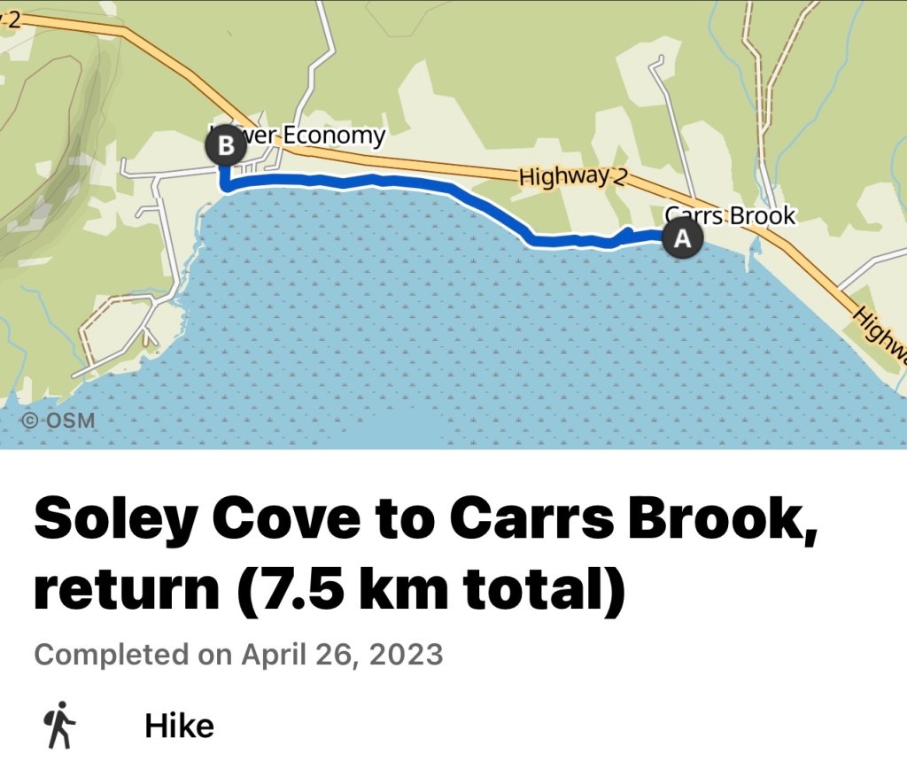
My friends and I embarked on a little hike today exploring a beach none of us had checked out before. The weather was perfect, the hiking group as well!
It was a short 20 minute drive to Soley Cove Road where we parked the car close to beach access. The sun was out after a cloudy morning and we climbed down the stairs to the beach. We arrived at exactly low tide. The water was out far which assured us that there would be enough time to explore the beach and cliffs toward Carrs Brook.
We hiked for just under two hours. This was easy on the knees and hips and the verdict was to return and walk the entirety of the cliffs soon. Everyone gave it two thumbs up and a big smile!
Hope you enjoy the images of these unique Jurassic sandstone formations. Happy Wednesday, Anna
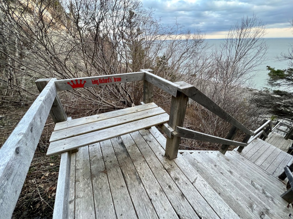
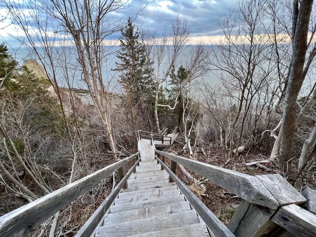
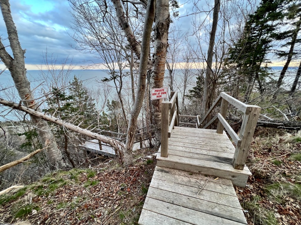
There is a hidden private staircase leading to the beach near the “Old Man” sea stack close to Clarke Head. To get prepared for a multi-day backpacking excursion I have decided to use these 176 steps to optimize my cardio fitness.
These images are from last night. I climbed the stairs twice… I am hauling my backpack along tonight. My goal is three ascends!
The sun is out now and the chilly day has warmed up. Wish me luck, Anna
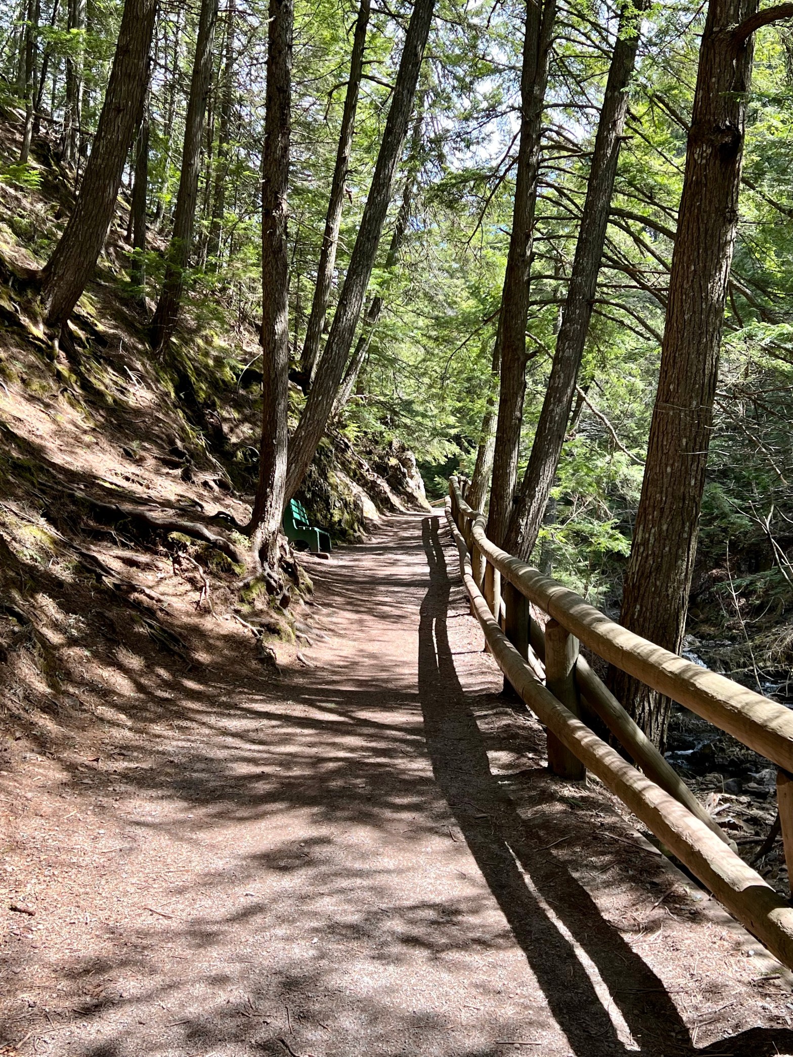
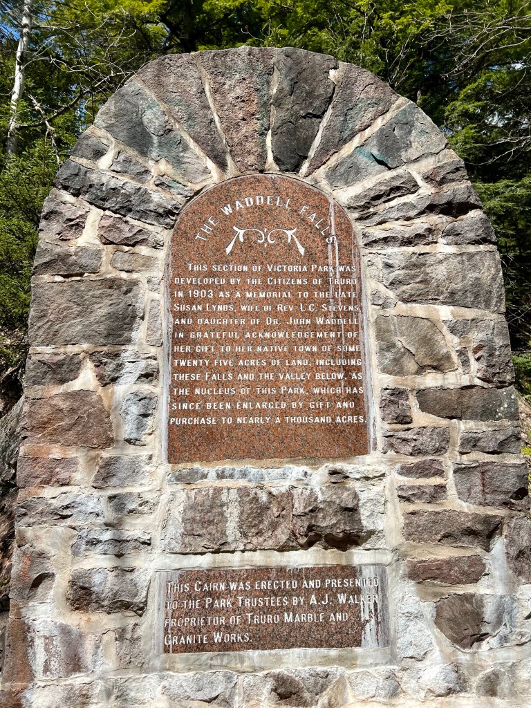
…make time to head over to Victoria Park. The parking lot is accessed via Part Street and there is plenty of space including many shaded spots. My friend Gaby and I had some time to spare and she offered to show me around this popular destination.
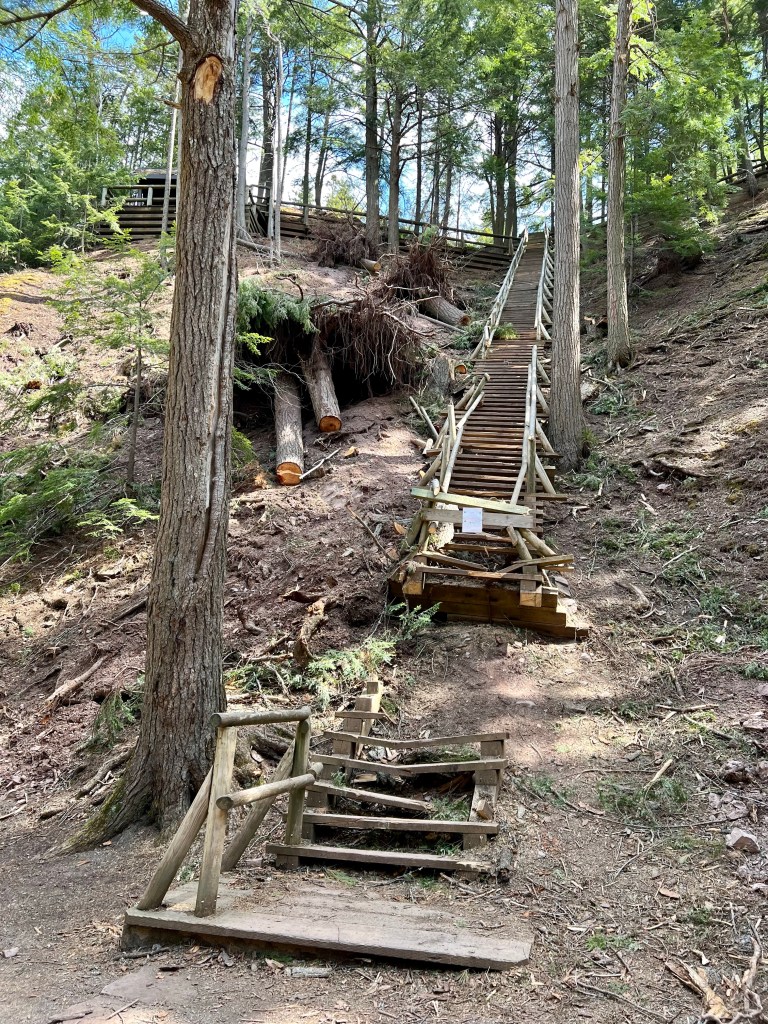
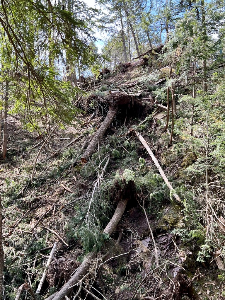
I had read about the extensive damage left by Hurricane Fiona last September, exactly 7 months ago to the day. Much has been cleaned up but many of the paths continue to be closed awaiting further repairs.
Our destination today was the waterfall. I can see why this spot is so popular!
We climbed the stairs toward the main road and returned to the car. The whole walk took just over 30 minutes and logged in at 2 km. A nice break to our day in the city!
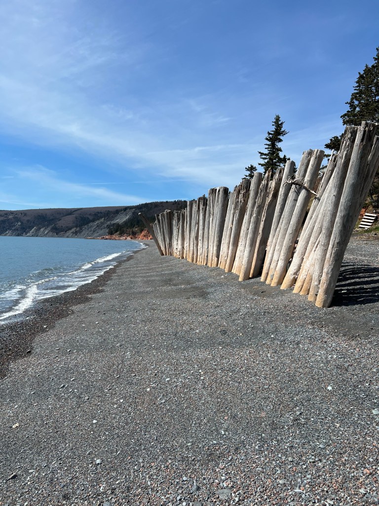
A sunny Sunday afternoon, high tide with waves gently lapping at the shore this beach is perfect for a leisurely walk. I had not been here since last fall and was surprised by the wooden breakwater no longer protecting a small beach cottage.
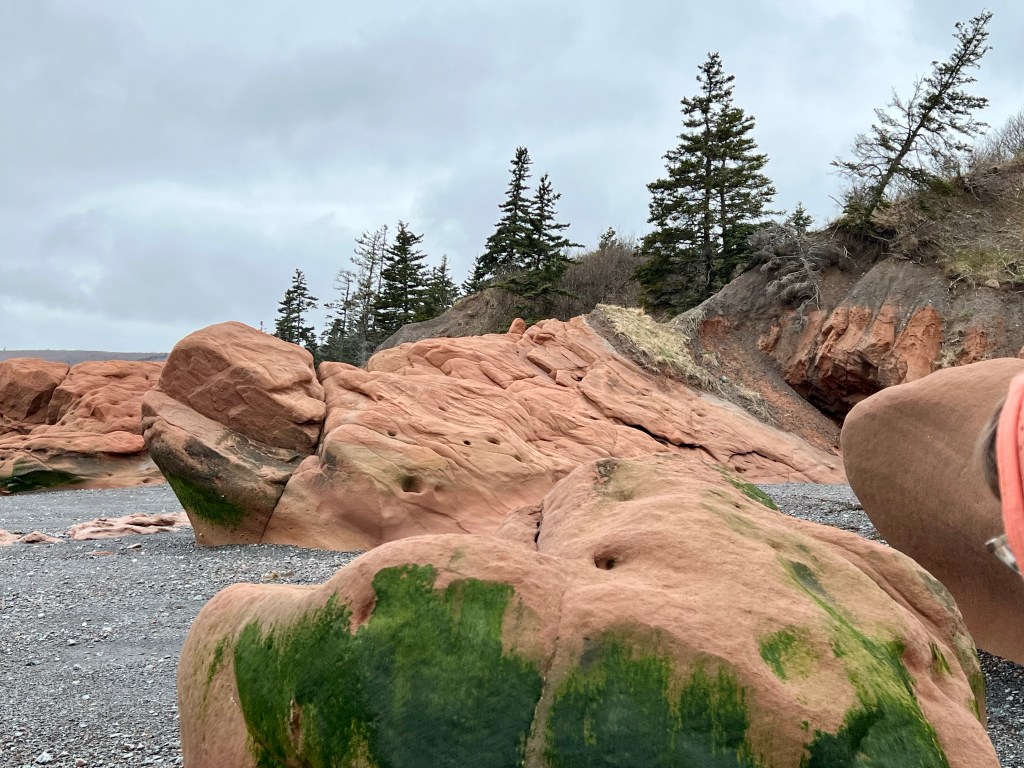
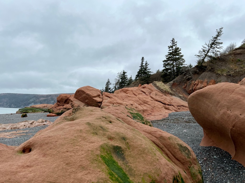
The ultimate highlight for me are the Red Rocks near the Cape Chignecto Provincial Park Trailhead. Combined with the high tide level and bright blue sky overhead magic presented itself once again.
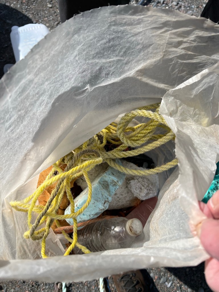
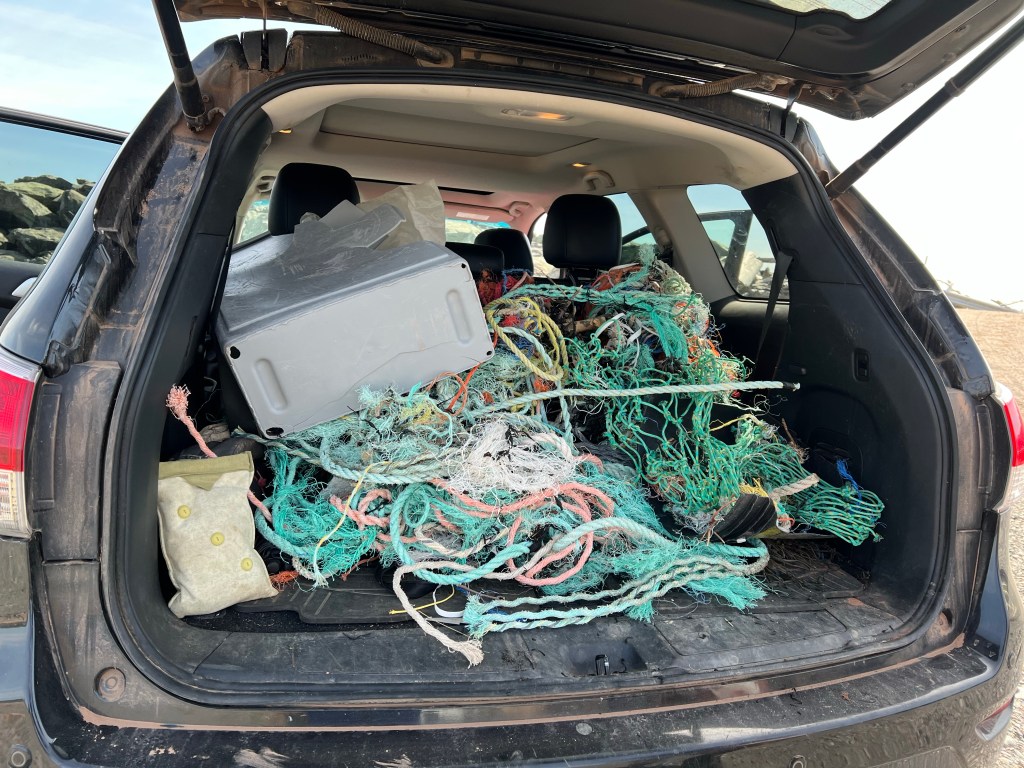
On our way back to the car we relieved this stretch of beach of another 35.5 lbs of trash. An afternoon well spent!
Happy Sunday, everyone! Best wishes for a fabulous week ahead, Anna
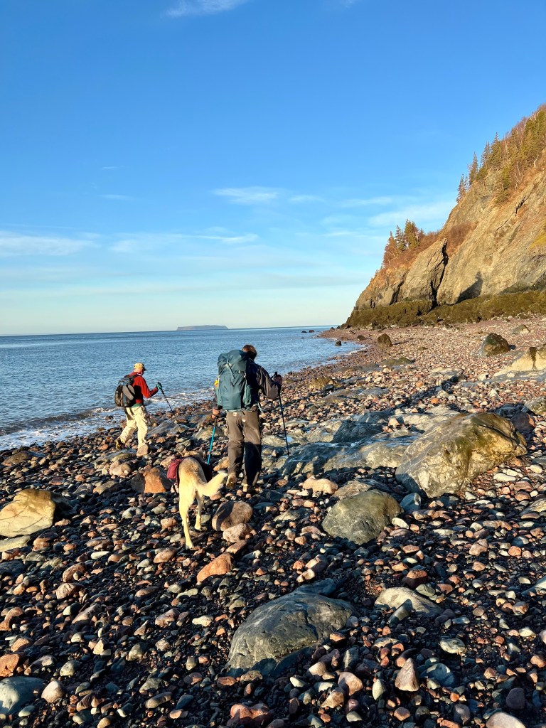
The alarm rang at 4 am, picking up my friend at 4:45 and the drive to West Advocate seemed even more curvy in the dark. We arrived in good time and only waited a couple minutes before our third hiking friend rolled into the parking lot. We set out for the trailhead knowing full well that…
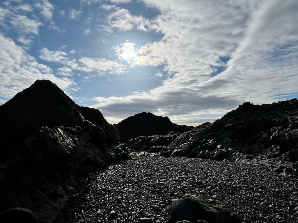
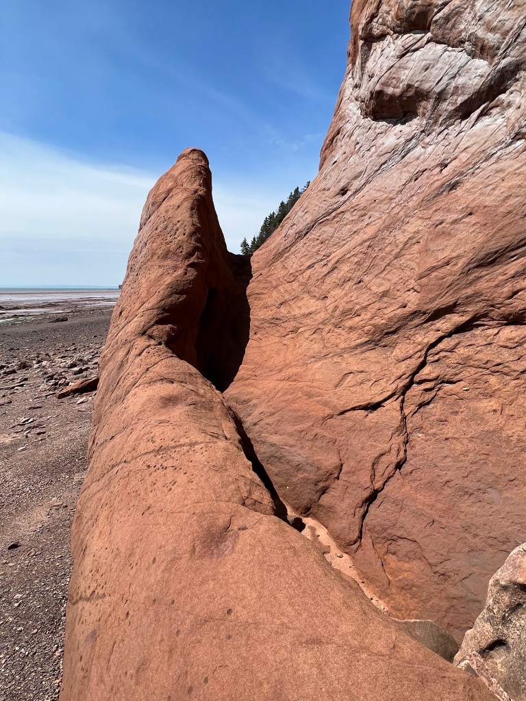
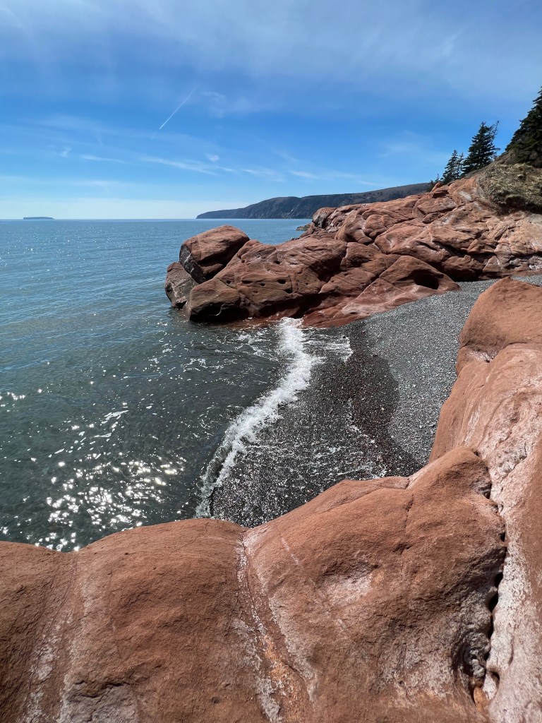
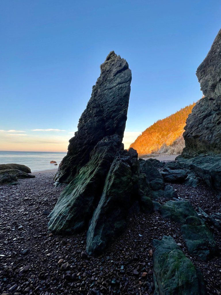
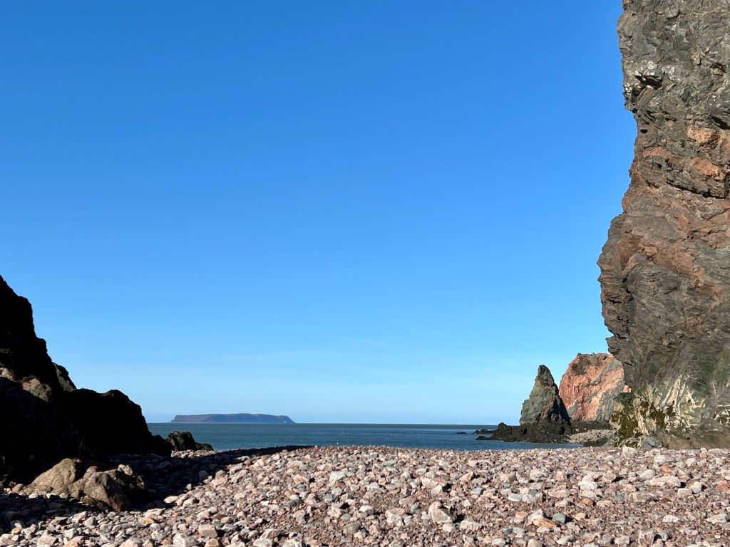
Our packs were on the heavier than normal side because we carried rubber boots, just in case…. Just in case the pinch points along the beach would not be cleared enough for dry passage. Well, suffice it to say: we didn’t need them😁. Yesterday was the lowest tide for the month at only about +30cm and we were willing to chance hiking to visit The Fang, Mermaid’s Cave, Old Sal and Refugee Cove.
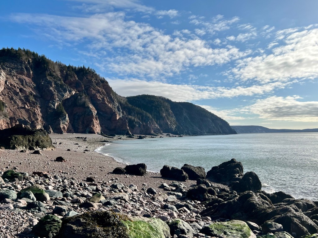
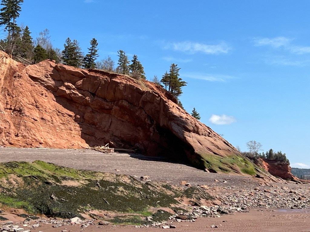
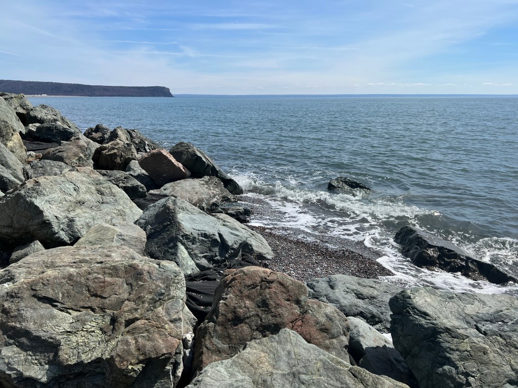
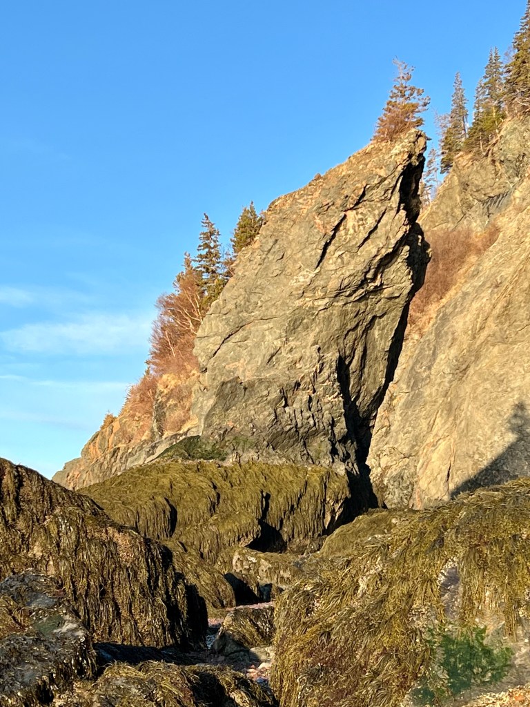
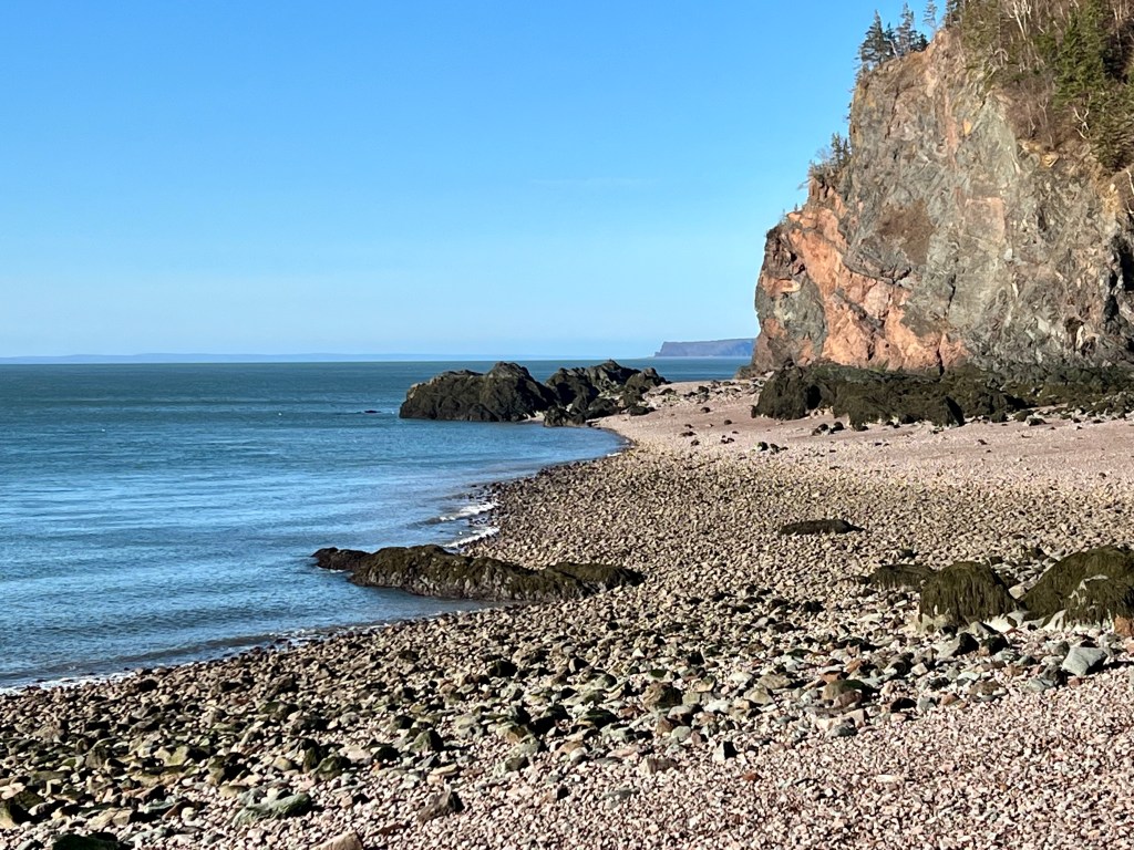
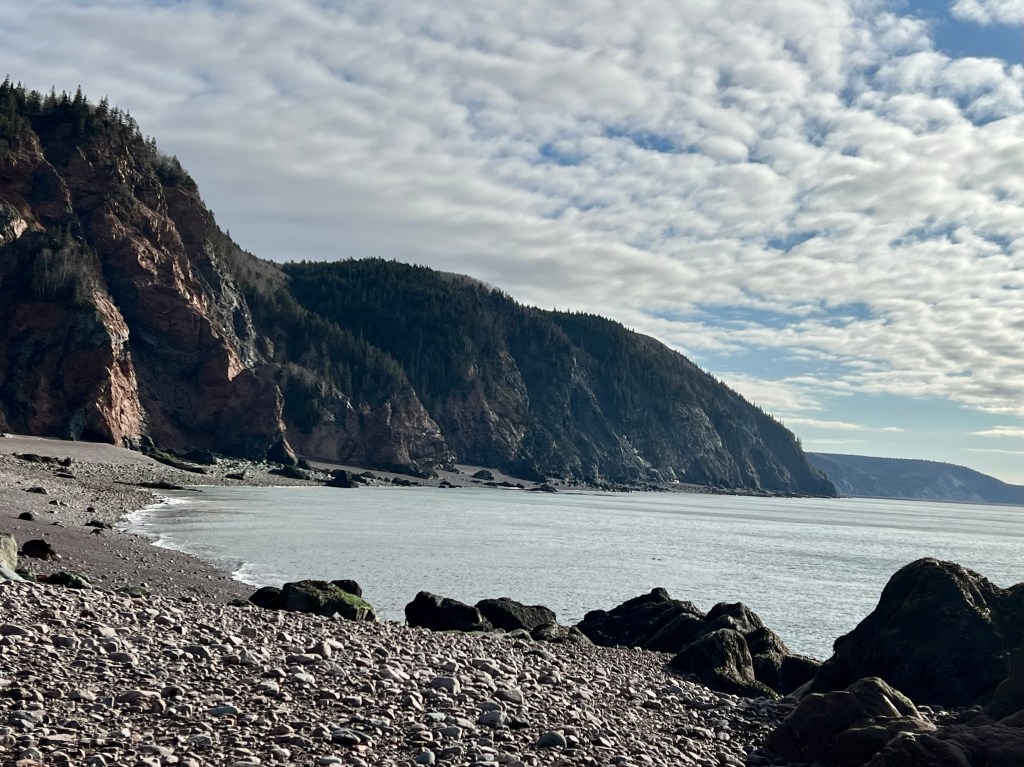
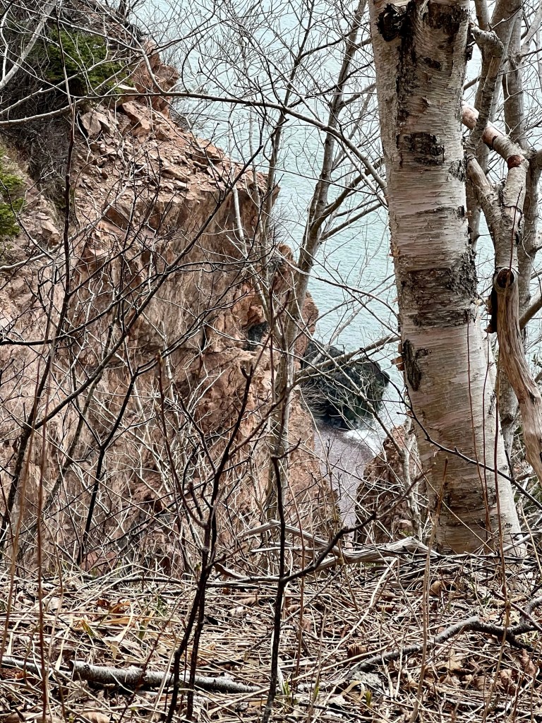
The sun soon rose casting amazing light and fully illuminating the 600 m high cliffs and various geological formations along the way. I had hiked this stretch about 11 months ago. This year I was able to take it all in again and take note of significant changes, sure proof of constant environmental changes to the Earth’s climate.
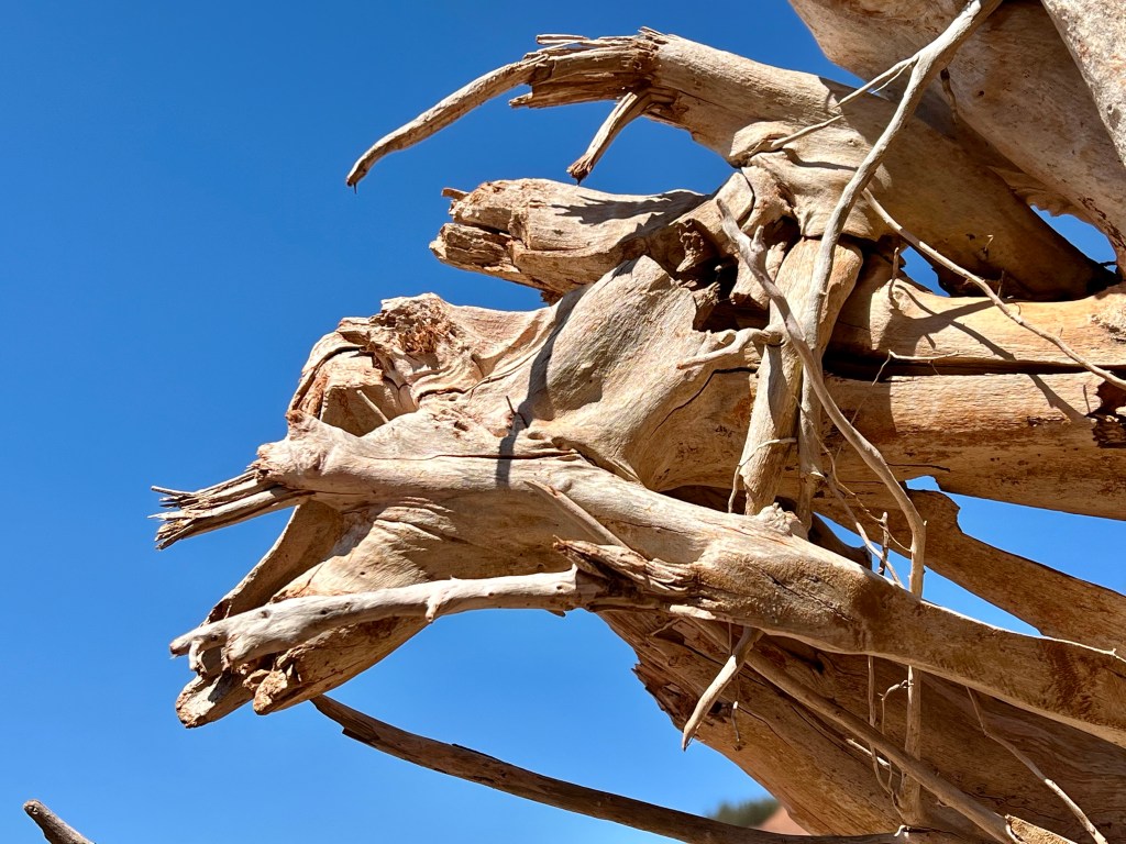
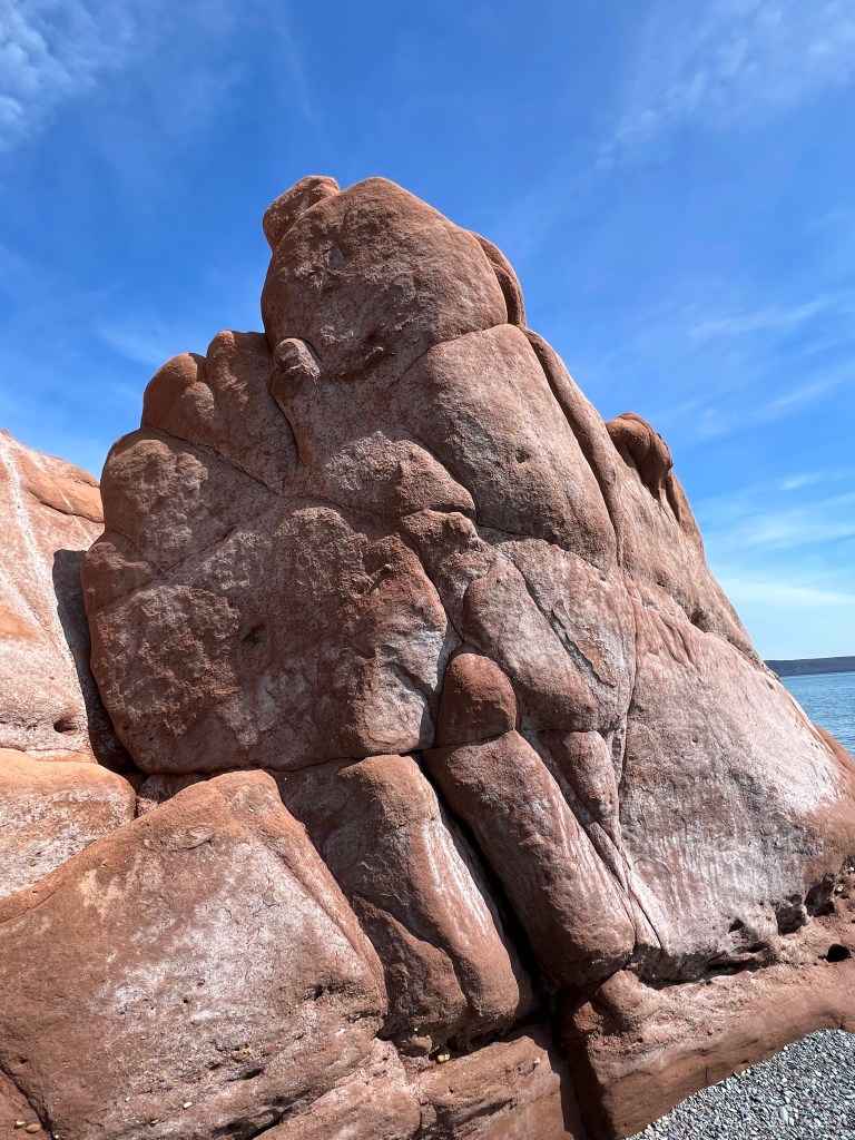
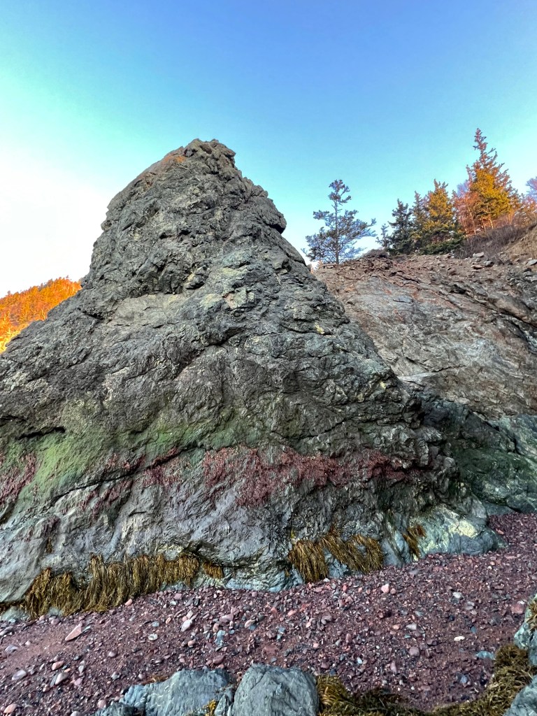
The Cape Chignecto area is easily one of the most impressive places I have ever visited and explored. “The Fang” was bathed in the most favourable light, water falls were dancing from great heights fanning out at beach level to quench our canine companion’s thirst, and the keyhole had doubled in size since last May. I was in a constant state of awe!
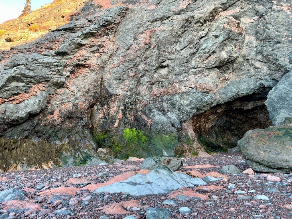
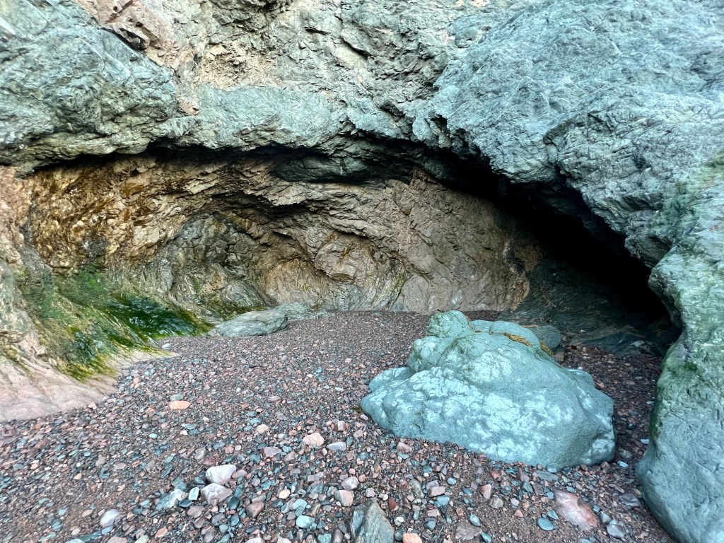
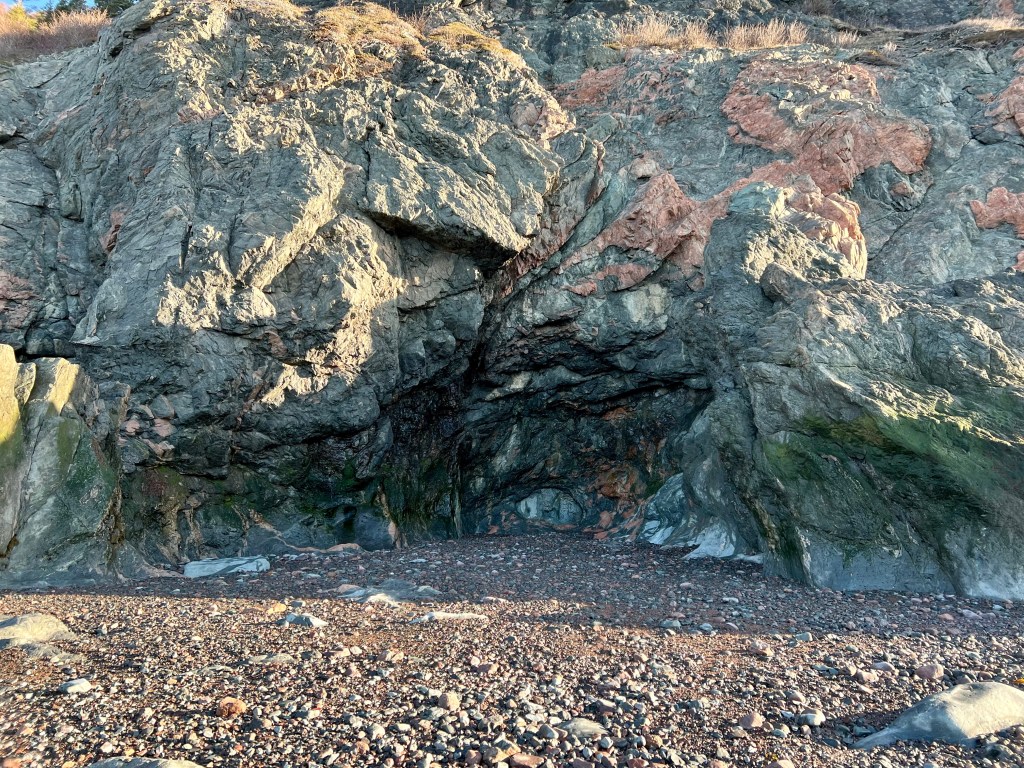
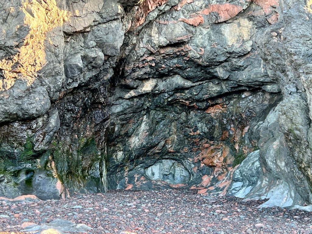
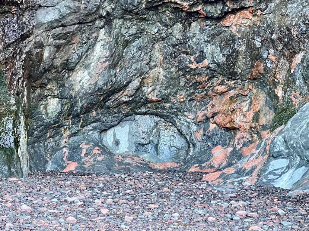
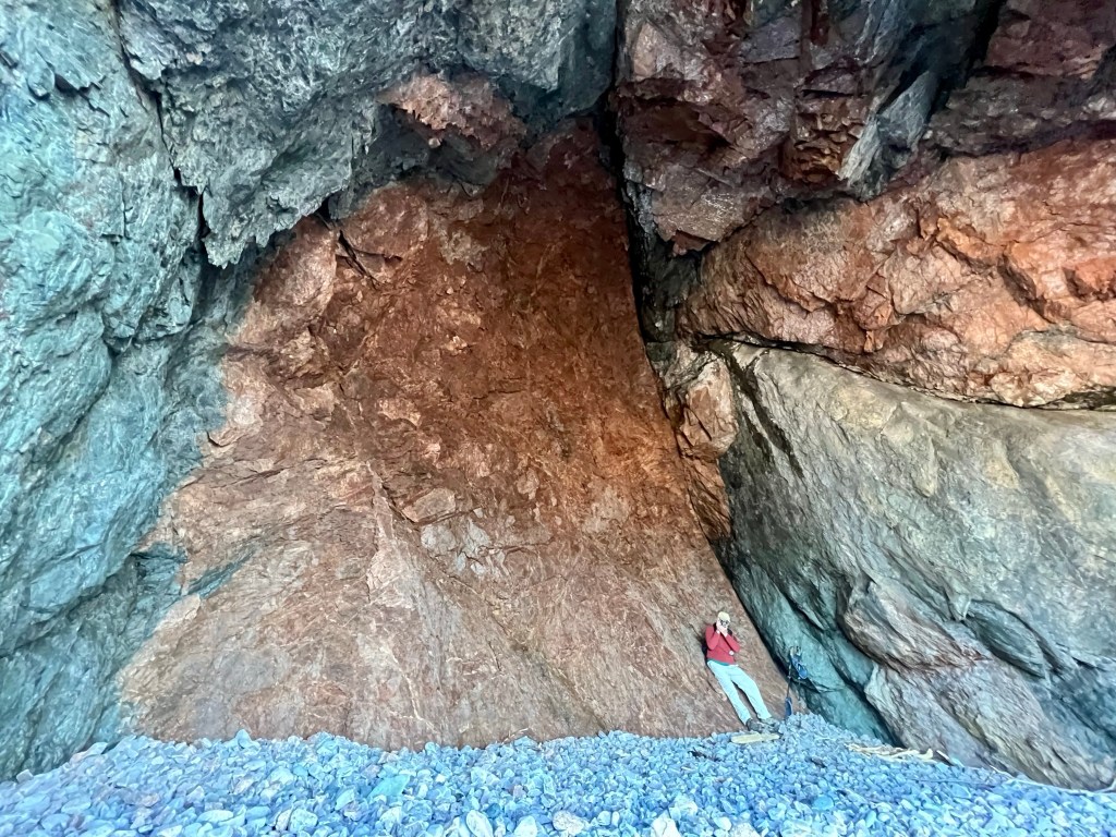
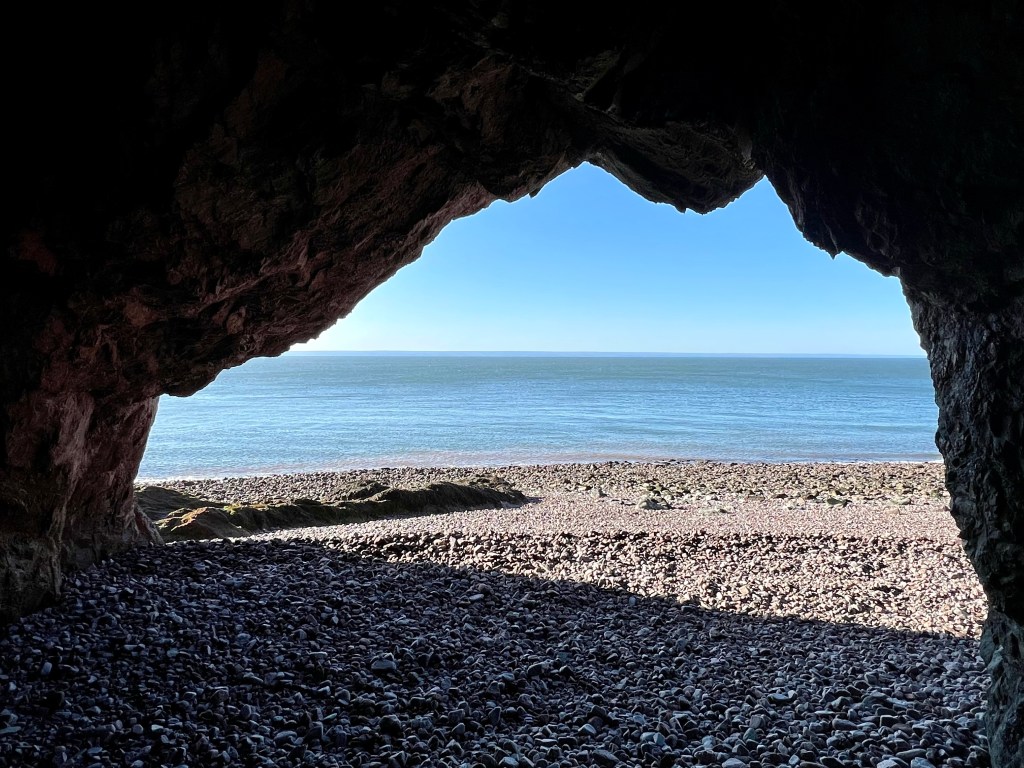
I came upon a new cave carved out by tidal action. The opening beckoned to enter, mysterious light illuminating it to the point where I expected another opening inside but there was nothing! The cave does not have a name… yet!
And just a little further along, another new cave. The inner oval waiting to be commanded to slide aside. “Open Sesame” did not work. But what a great discovery!
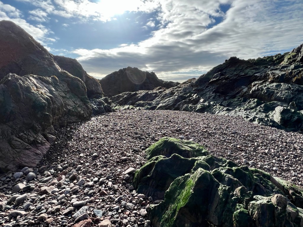
“Mermaid’s Cave” was barely recognizable! The relentless tides and wind had completely transformed the formerly sandy beach into a field of rubble. Large pebbles were piled up high and we had to climb up into the cave to explore.
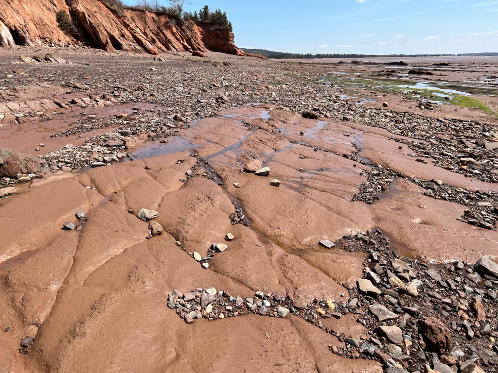
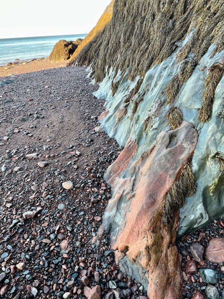
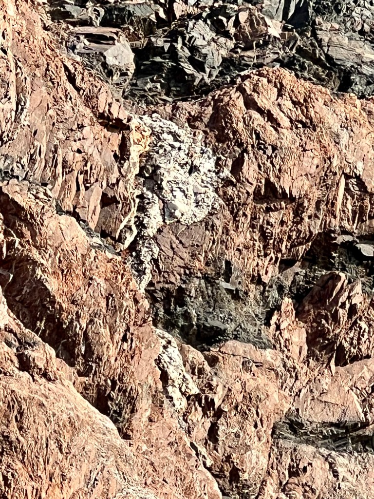
Scrambling over rocky beach terrain I was grateful for my trusty hiking boots. We came upon another discovery high up. By the way the light refracted we determined it to be a Quartz seam.
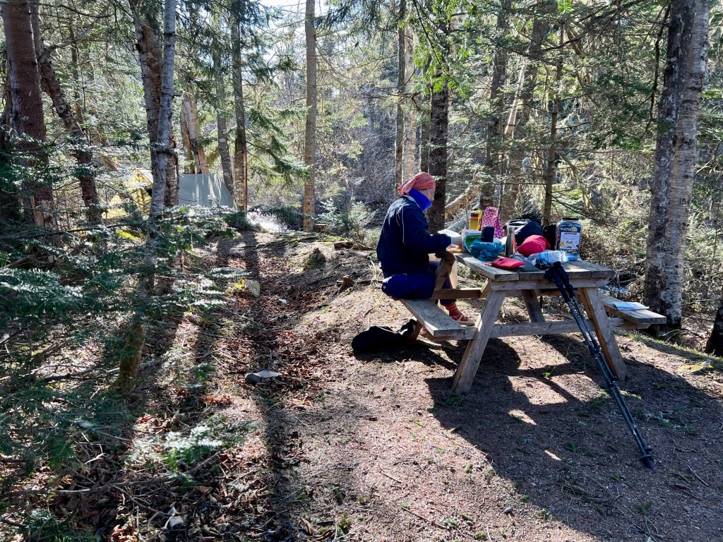
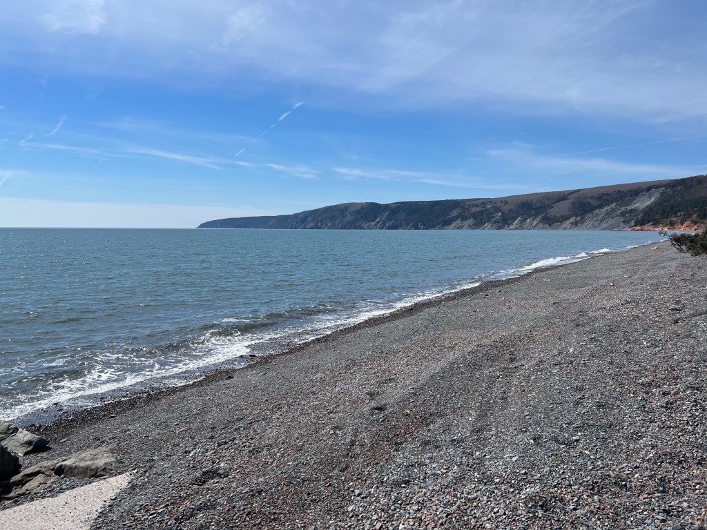
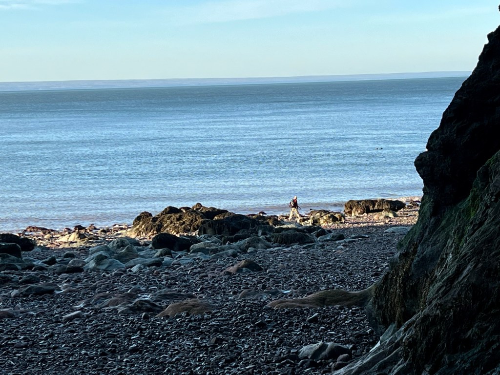
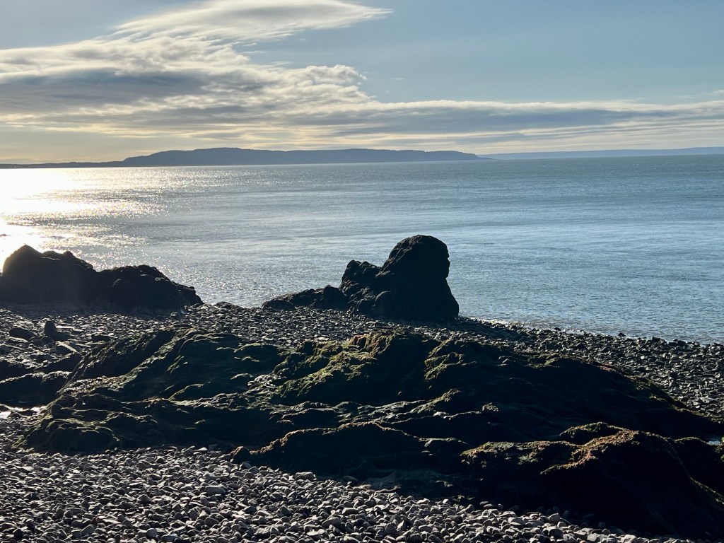
And then we arrived: Refugee Cove was beckoning in all it’s splendour. I called it Middle Earth as it was so full of discovery and wonder. We had hiked approximately 10 km and spent the next hour just exploring.
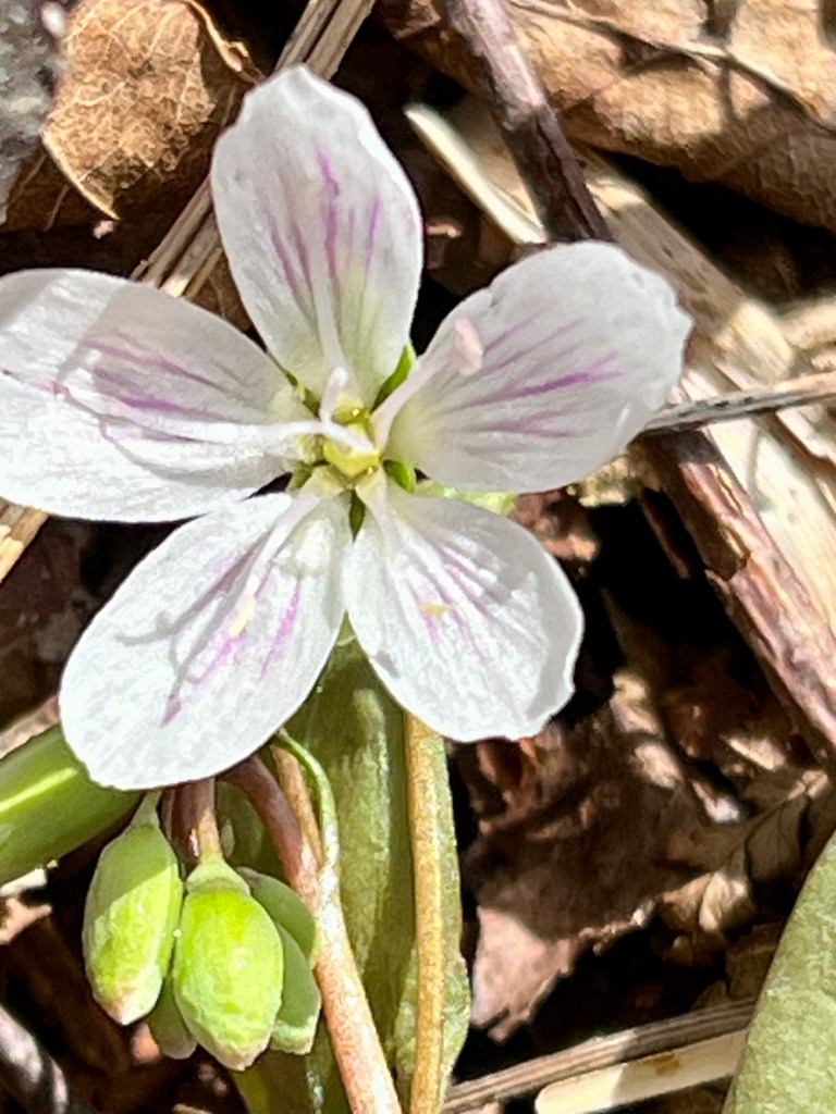
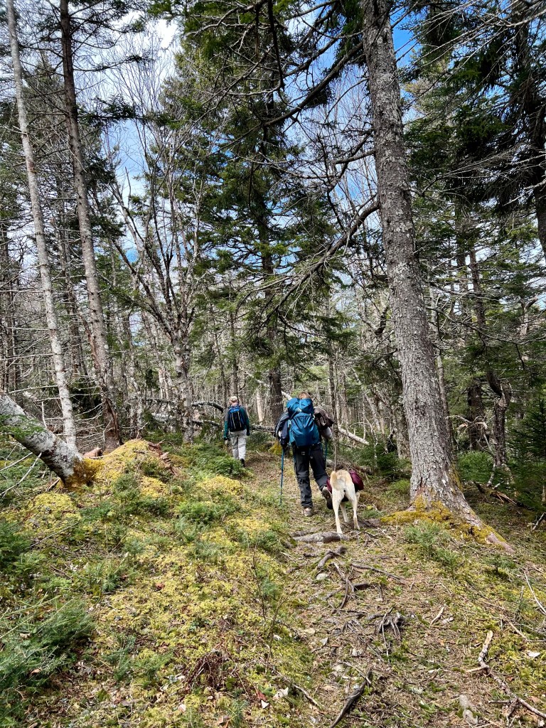
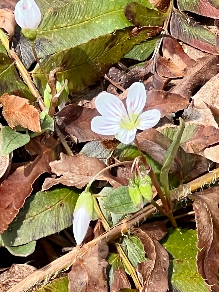
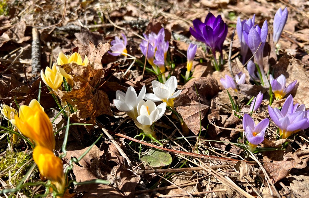
This rest is vital as the next stretch leads uphill, a steep uphill (500 m) over about 1,100 m to the top of cliff #1. The rewards are spectacular views and early spring flowers. The trail leads through beautiful woodlands with manageable terrain, the elevation changed and eventually we arrived at…
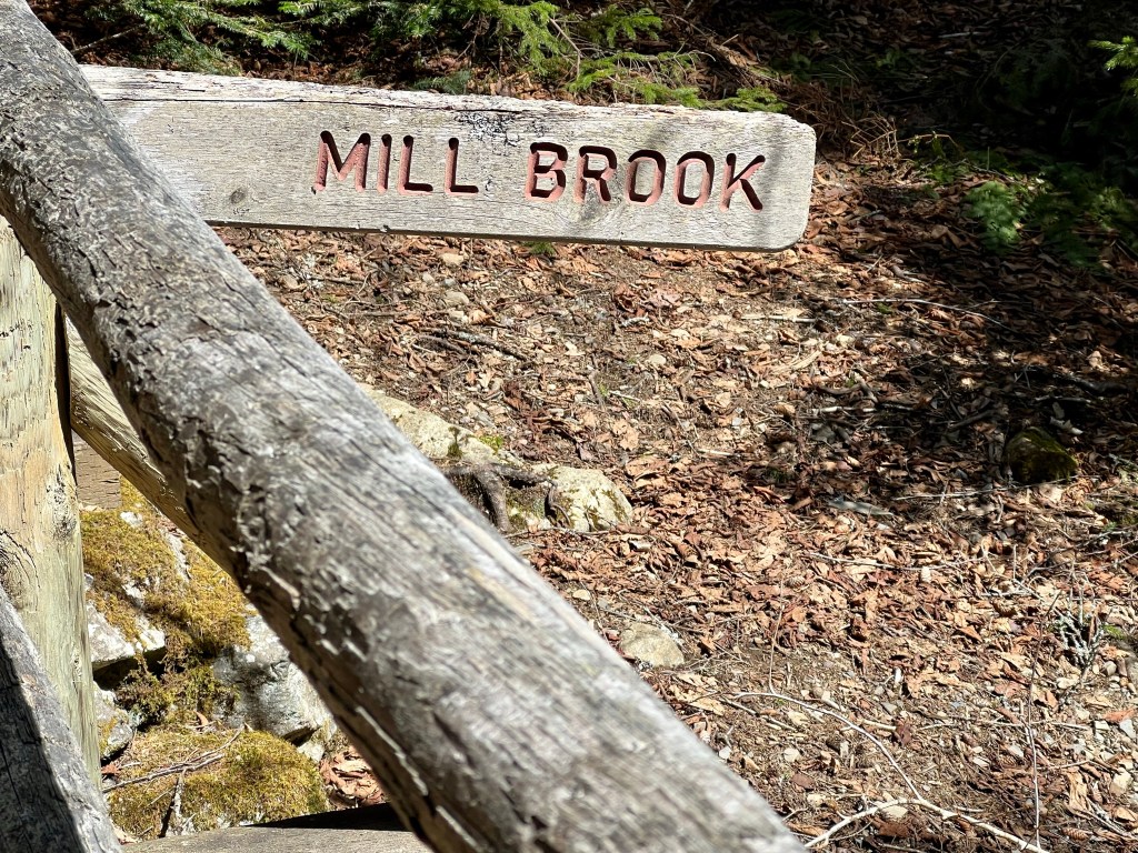
Mill Brook Hill, as they call it, highly understates what comes next. I tried to capture it in pictures but the trail looks like any other uphill path. The “hill” leads up a steep, 2 km long path. “Don’t look up” is good advice as one cannot see the end of it. Just getting into a slow and steady pace, setting one foot in front of the other and perhaps counting to a certain number below 30 is the best advice to receive. Brian counts to 28, my magic number yesterday was 20. We made it! I took it slow, rested regularly and was happy to see how fast I recovered my steady breath.
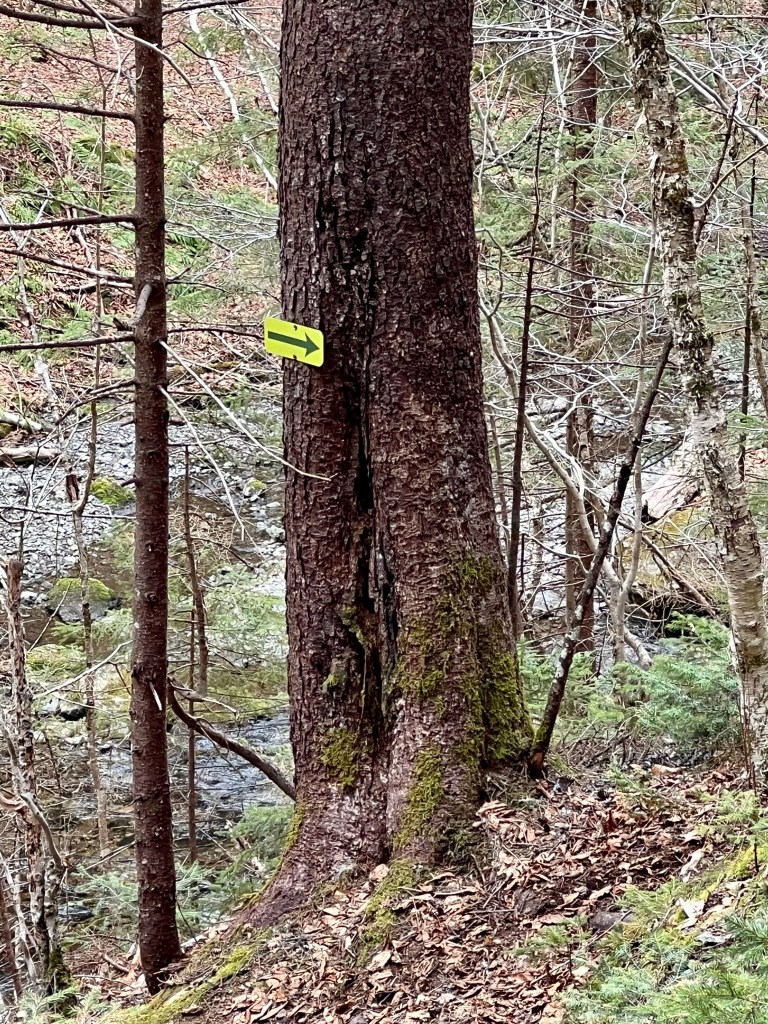
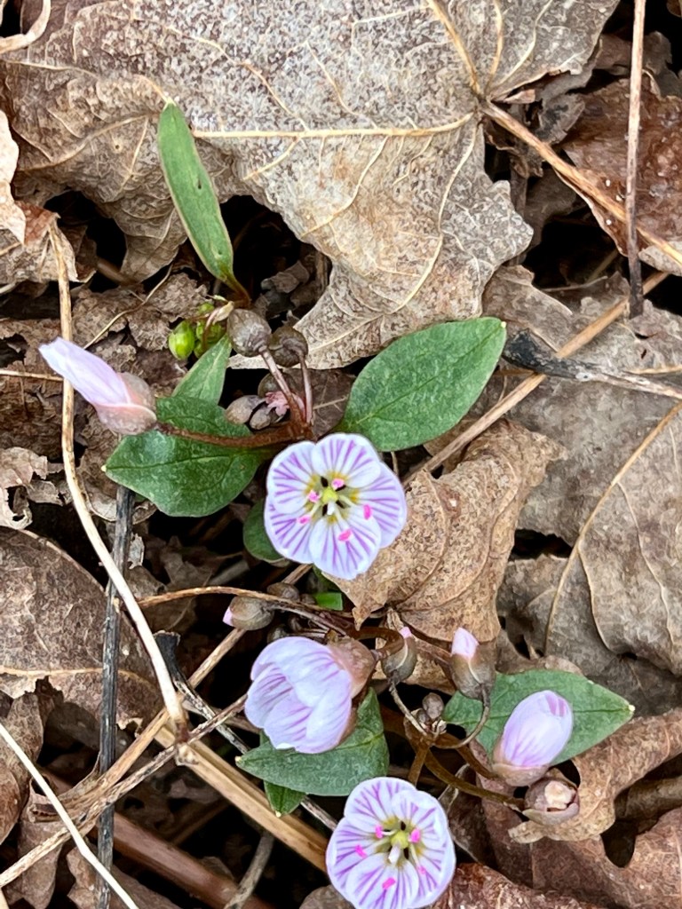
More tiny flowers sprinkled across the forest floor, spectacular views and directional signs lead the way.
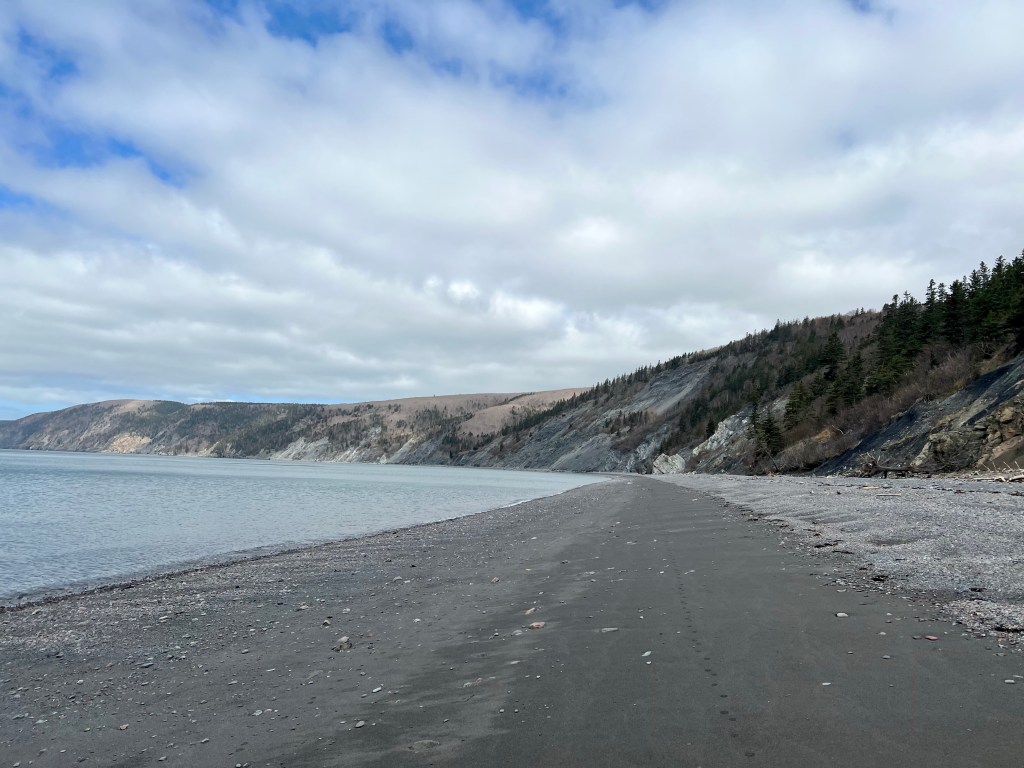
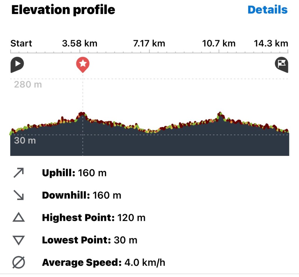
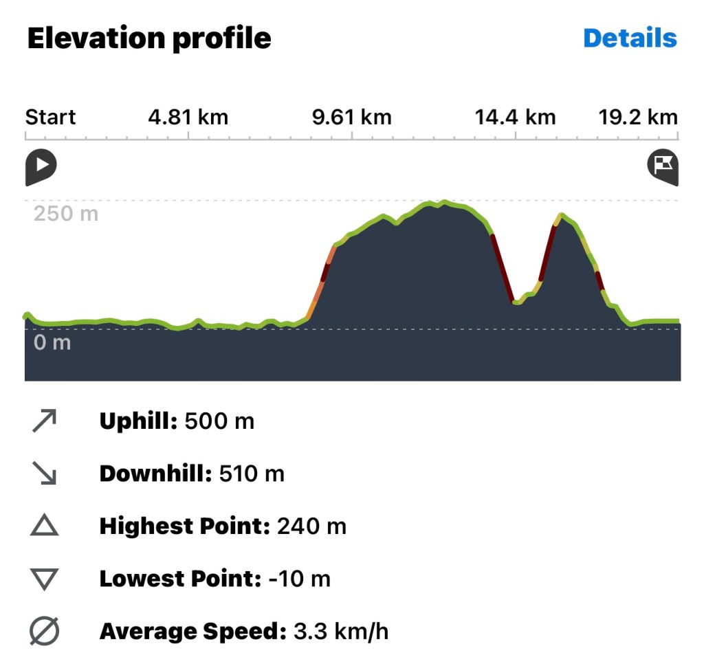
We chose to conclude our nearly 20 km hike with one last stretch of beach. It was where we had started the hike at 6 am just as the sun was slowly cresting on the horizon. Our hike time may not have been as fast as last year but we certainly made many new discoveries and took our time to appreciate the awe-inspiring landscape. Here is a detailed graphic of the terrain we navigated:
A fantastic hike with fabulous, like-minded friends! Happy Earth Day, Anna
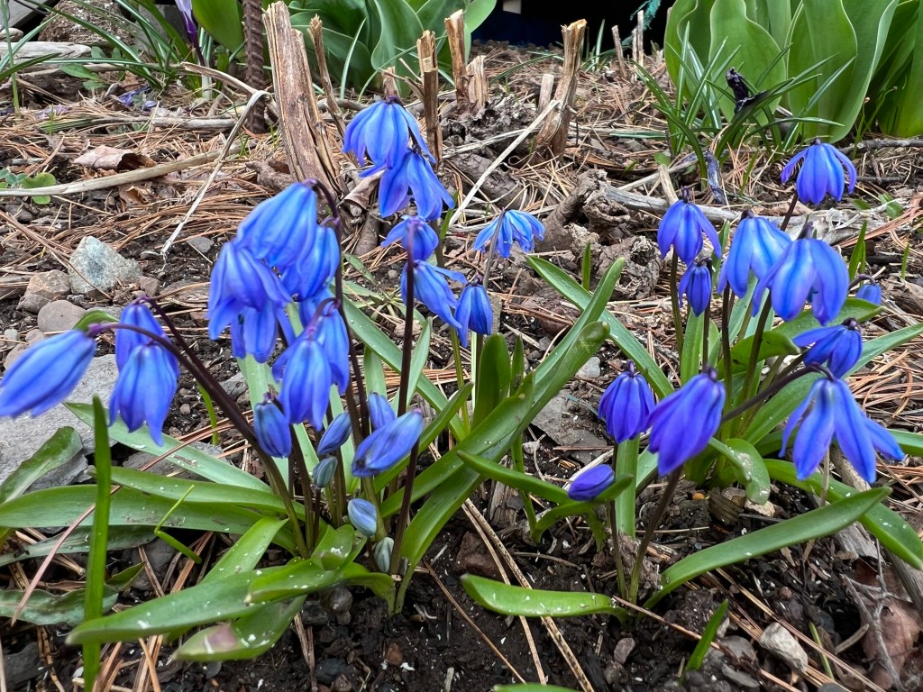
It was a bit gray in Parrsboro today but signs of flowers and leaves budding are everywhere. My heart is full tonight! Thank you NSWalks for nominating me as one of the community volunteers contributing to life in Cumberland County.
I just returned home from an evening of celebration, meeting other volunteers and shaking hands with community leaders.
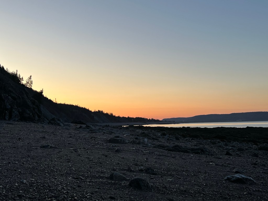
Basking in the golden glow of the setting sun… good night, friends!